Area Overview for KT22 8TR
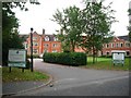
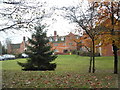
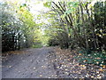
Photos of KT22 8TR


Area Information
KT22 8TR is a small residential cluster in England, home to 1,875 people. This area is defined by its compact size and quiet, settled character. The community is predominantly composed of adults aged 30–64, with a median age of 47, suggesting a mature, stable population. Daily life here is shaped by proximity to local amenities and a low crime rate, which contributes to a sense of safety. The area is not densely populated, offering a balance between urban convenience and suburban tranquillity. Residents benefit from access to nearby schools, retail outlets, and rail links, making it a practical choice for families and professionals. The housing stock is largely owner-occupied, with 84% of homes owned by residents, indicating a long-term, community-focused demographic. While the area lacks major landmarks or tourist attractions, its appeal lies in its simplicity and reliability. Living in KT22 8TR means prioritising practicality over spectacle, with a focus on family life, local services, and a low-risk environment. The postcode’s small size means it is best suited for those seeking a straightforward, uncluttered lifestyle without the complexities of larger urban areas.
- Area Type
- Postcode
- Area Size
- Not available
- Population
- 1875
- Population Density
- 1897 people/km²
KT22 8TR is primarily an owner-occupied area, with 84% of homes owned by residents. The accommodation type is predominantly houses, which is typical for smaller residential clusters. This suggests a market skewed towards family homes rather than apartments or rental properties. The high home ownership rate indicates a stable, long-term demographic, with fewer short-term renters. The area’s small size means property availability is limited, and buyers should consider proximity to nearby amenities as a key factor. The presence of multiple schools, including St Andrew’s Catholic School (Ofsted rating: outstanding), may influence property values, as education quality is a major consideration for families. For buyers, the housing stock offers a straightforward choice: semi-detached or detached homes in a low-risk, low-maintenance environment. The lack of high-density development means the area is unlikely to experience rapid price fluctuations. However, the limited size of KT22 8TR means that property searches should extend to adjacent postcodes for more options.
House Prices in KT22 8TR
No properties found in this postcode.
Energy Efficiency in KT22 8TR
Residents of KT22 8TR have access to a range of local amenities within practical reach. Retail options include The Southern Co-operative Co, Morrisons Daily, and M&S Ashstead, offering everyday shopping needs. These stores provide convenience for household essentials, groceries, and general retail. The presence of multiple retail outlets suggests a well-served community, though the area does not host large shopping centres or high-street chains. For leisure, the nearby rail stations connect to broader networks, enabling trips to larger towns for dining or entertainment. While the data does not specify parks or leisure facilities, the area’s low crime rate and quiet character imply a focus on local, low-key amenities. The combination of retail, rail access, and a stable community contributes to a lifestyle that prioritises practicality and ease of access over luxury or novelty. This makes KT22 8TR ideal for those seeking a straightforward, service-oriented daily life without the need for extensive travel.
Amenities
Schools
Residents of KT22 8TR have access to several schools, including West Ashtead Primary School and West Ashtead Primary Academy, both of which are primary schools. St Andrew’s Catholic School, also a primary school, holds an outstanding Ofsted rating, making it a notable option for families. Independent schools such as Parsons Mead School and Downsend School are also nearby, offering alternative educational pathways. The mix of state and independent schools provides flexibility for parents, whether they prioritise affordability or specialist education. For families, the presence of an outstanding-rated primary school is a significant advantage, as it may reduce the need to commute to other areas for education. The concentration of schools within practical reach suggests that KT22 8TR is well-suited for households with children, with options to suit different preferences and budgets. The proximity of these institutions reinforces the area’s appeal as a family-friendly location.
| Rank | School | Type | Entry gender | Ages |
|---|
Explore more schools in this area
Go to Schools tabDemographics
The population of KT22 8TR is 1,875, with a median age of 47. The majority of residents fall into the 30–64 age range, reflecting a community of working-age adults and families. Home ownership is high, at 84%, indicating a strong presence of long-term residents. The predominant accommodation type is houses, which aligns with the area’s residential character. The predominant ethnic group is White, with no data provided on other demographics. The absence of specific information on diversity or deprivation means the community’s composition is not explicitly detailed, but the high home ownership rate and age profile suggest a stable, middle-aged population. This demographic profile implies a focus on family life and local services, with fewer transient residents. The area’s safety record, including a crime risk score of 92 (low risk), further supports a low-stress environment. For quality of life, the combination of low crime, mature residents, and owner-occupied homes suggests a predictable, community-oriented lifestyle.
Household Size
Accommodation Type
Tenure
Ethnic Group
Religion
Household Composition
Age
Household Deprivation
NS-SEC
Explore more demographic insights in this area
Go to Demographics tabPlanning
Planning Constraints
- Flood RiskPremium
- Ramsar Wetland SitesPremium
- Area of Outstanding Natural BeautyPremium
- Protected Nature ReservePremium
- Protected WoodlandPremium