Area Overview for KT22 8NJ
Photos of KT22 8NJ


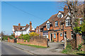
71 photos from this area
Area Information
Key information about the KT22 8NJ including its size, population, and administrative classification.
- Area Type
- Postcode
- Area Size
- 1.4 hectares
- Population
- 1695
- Population Density
- 1650 people/km²
House Prices in KT22 8NJ
23
Properties
£631,071
Average Sold Price
£150,000
Lowest Price
£1,190,000
Highest Price
Showing 23 properties
| Address | Type | Beds | Baths | Last Sale Price | Last Sale Date | |
|---|---|---|---|---|---|---|
| 46 Highlands Road, Leatherhead, KT22 8NJ | Semi-detached | 4 | 3 | £600,000 | Apr 2024 | |
| 42 Highlands Road, Leatherhead, KT22 8NJ | Detached | 3 | - | £1,010,000 | May 2021 | |
| 54 Highlands Road, Leatherhead, KT22 8NJ | house | - | - | £775,000 | Nov 2020 | |
| The Lodge House, 56 Highlands Road, Leatherhead, KT22 8NJ | Detached | 3 | 3 | £950,000 | Jul 2020 | |
| Avonwood, Highlands Road, Leatherhead, KT22 8NJ | Bungalow | - | - | £735,000 | Aug 2018 | |
| 30 Highlands Road, Leatherhead, KT22 8NJ | Detached | 4 | 2 | £1,190,000 | Mar 2017 | |
| 34 Highlands Road, Leatherhead, KT22 8NJ | Semi-detached | 3 | 1 | £535,000 | Sep 2014 | |
| 40 Highlands Road, Leatherhead, KT22 8NJ | house | 3 | - | £500,000 | Feb 2012 | |
| The Squirrels, Highlands Road, Leatherhead, KT22 8NJ | Detached | - | - | £715,000 | Jun 2007 | |
| 32 Highlands Road, Leatherhead, KT22 8NJ | Detached | 6 | 2 | £565,000 | Oct 2003 |
Page 1 of 3
Energy Efficiency in KT22 8NJ
Amenities
Schools
| Rank | School | Type | Entry gender | Ages |
|---|
Explore more schools in this area
Go to Schools tabDemographics
Household Size
One person
most common
Accommodation Type
Houses
most common
Tenure
75
majority
Ethnic Group
White
most common
Religion
N/A
most common
Household Composition
N/A
most common
Age
47
median
Adults (30-64 years)
most common
Household Deprivation
N/A
with no deprivation
NS-SEC
51
in Lower managerial occupations
Explore more demographic insights in this area
Go to Demographics tabPlanning
Planning Constraints
- Flood RiskPremium
- Ramsar Wetland SitesPremium
- Area of Outstanding Natural BeautyPremium
- Protected Nature ReservePremium
- Protected WoodlandPremium