Area Overview for KT22 7PZ
Photos of KT22 7PZ
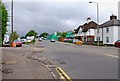
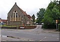
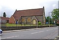
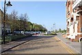

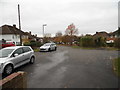
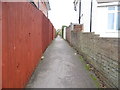


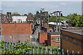
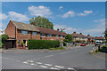
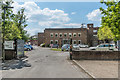
100 photos from this area
Area Information
Key information about the KT22 7PZ including its size, population, and administrative classification.
- Area Type
- Postcode
- Area Size
- 9940 m²
- Population
- 1728
- Population Density
- 2736 people/km²
House Prices in KT22 7PZ
39
Properties
£288,657
Average Sold Price
£72,000
Lowest Price
£466,000
Highest Price
Showing 39 properties
| Address | Type | Beds | Baths | Last Sale Price | Last Sale Date | |
|---|---|---|---|---|---|---|
| 184 Kingston Road, Leatherhead, KT22 7PZ | Terraced | 3 | 1 | £365,000 | May 2025 | |
| 166 Kingston Road, Leatherhead, KT22 7PZ | Semi-detached | 3 | 2 | £466,000 | Feb 2025 | |
| 186 Kingston Road, Leatherhead, KT22 7PZ | Terraced | 3 | 1 | £380,000 | Jan 2025 | |
| 156 Kingston Road, Leatherhead, KT22 7PZ | Terraced | 1 | 1 | £399,000 | Oct 2024 | |
| 188 Kingston Road, Leatherhead, KT22 7PZ | Retail | 3 | 1 | £400,000 | Jun 2022 | |
| 174 Kingston Road, Leatherhead, KT22 7PZ | Flat | 1 | - | £207,500 | May 2022 | |
| 194 Kingston Road, Leatherhead, KT22 7PZ | Terraced | 5 | 2 | £365,000 | May 2022 | |
| 206 Kingston Road, Leatherhead, KT22 7PZ | house | - | - | £400,000 | Oct 2021 | |
| 230 Kingston Road, Leatherhead, KT22 7PZ | Flat | - | - | £212,500 | Dec 2020 | |
| 202 Kingston Road, Leatherhead, KT22 7PZ | Terraced | 3 | 1 | £350,000 | Nov 2019 |
Page 1 of 4
Energy Efficiency in KT22 7PZ
Amenities
Schools
| Rank | School | Type | Entry gender | Ages |
|---|
Explore more schools in this area
Go to Schools tabDemographics
Household Size
Family (3-5 people)
most common
Accommodation Type
Houses
most common
Tenure
46
majority
Ethnic Group
White
most common
Religion
N/A
most common
Household Composition
N/A
most common
Age
47
median
Adults (30-64 years)
most common
Household Deprivation
N/A
with no deprivation
NS-SEC
27
in Lower managerial occupations
Explore more demographic insights in this area
Go to Demographics tabPlanning
Planning Constraints
- Flood RiskPremium
- Ramsar Wetland SitesPremium
- Area of Outstanding Natural BeautyPremium
- Protected Nature ReservePremium
- Protected WoodlandPremium