Area Overview for KT22 7NN
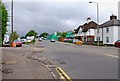
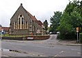
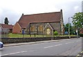
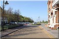
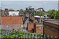
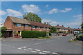
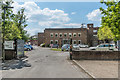
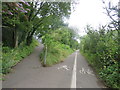
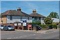
Photos of KT22 7NN


Area Information
KT22 7NN is a small residential postcode area in England, home to 2,275 residents spread across a compact cluster of homes. With a population density of 534 people per square kilometre, the area balances a sense of community with manageable size. The median age of 47 suggests a mature demographic, with the majority of residents falling between 30 and 64 years old. This is a place where houses dominate the housing stock, and 65% of residents own their homes. Daily life here is shaped by proximity to local amenities, including retail outlets and rail stations, while the area’s low flood risk and absence of protected natural sites make it a practical choice for families. KT22 7NN offers a quiet, stable environment with access to essential services, making it appealing to those seeking a settled lifestyle without the pressures of urban density.
- Area Type
- Postcode
- Area Size
- Not available
- Population
- 2275
- Population Density
- 534 people/km²
KT22 7NN is primarily an owner-occupied area, with 65% of residents living in homes they own. The housing stock is dominated by houses, reflecting a preference for single-family dwellings over flats or apartments. This suggests a market tailored to families or individuals seeking space and privacy. The small size of the postcode area means the property options are limited to the immediate cluster, though nearby areas may offer more variety. For buyers, the focus on owner-occupation indicates a stable market with potential for long-term investment. However, the absence of rental properties in the data suggests limited scope for buy-to-let activity. The predominance of houses also implies that properties here are likely to be larger, with features suited to those prioritising living space over urban convenience.
House Prices in KT22 7NN
No properties found in this postcode.
Energy Efficiency in KT22 7NN
The lifestyle in KT22 7NN is shaped by its proximity to essential amenities. Local shops such as Morrisons, M&S Leatherhead BP, and Lidl provide access to groceries, fuel, and everyday goods, reducing the need for long trips. The rail stations at Leatherhead, Ashtead, and Bookham offer direct links to nearby towns, enhancing connectivity for commuters or those seeking cultural and professional opportunities beyond the area. While the data does not mention parks or leisure facilities, the presence of retail and transport hubs suggests a practical, community-focused environment. The area’s small size means amenities are clustered closely, fostering a sense of convenience. For residents, this balance of local services and regional access supports a lifestyle that prioritises ease of living without sacrificing proximity to broader networks.
Amenities
Schools
The area is served by Therfield School, which operates as both a primary school and an academy. While the data does not specify Ofsted ratings, the presence of two educational institutions within the postcode suggests a range of options for families. The dual designation of Therfield School—covering both primary education and academy status—may indicate a blend of traditional and specialist teaching approaches. For parents, this offers flexibility, whether seeking a conventional primary school or an academy with potentially distinct curricula. The absence of other schools in the data means families may need to look slightly beyond KT22 7NN for secondary education, though the proximity to rail links could ease commuting to larger towns with more comprehensive schooling.
| Rank | School | Type | Entry gender | Ages |
|---|
Explore more schools in this area
Go to Schools tabDemographics
The population of KT22 7NN is predominantly adults aged 30–64, reflecting a mature community with a median age of 47. Home ownership is strong, with 65% of residents living in owner-occupied properties. The area is characterised by a high proportion of houses, suggesting a focus on family-friendly housing. The predominant ethnic group is White, though specific data on diversity or deprivation is not provided. The age profile indicates a stable, established population, likely with long-term ties to the area. With no mention of social housing or rental properties, the community appears to be largely self-contained, with a demographic that prioritises stability over transient living. The absence of detailed diversity metrics means the area’s cultural composition remains less defined in the data.
Household Size
Accommodation Type
Tenure
Ethnic Group
Religion
Household Composition
Age
Household Deprivation
NS-SEC
Explore more demographic insights in this area
Go to Demographics tabPlanning
Planning Constraints
- Flood RiskPremium
- Ramsar Wetland SitesPremium
- Area of Outstanding Natural BeautyPremium
- Protected Nature ReservePremium
- Protected WoodlandPremium