Area Overview for KT22 7LG
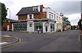
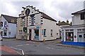
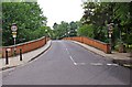
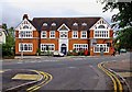
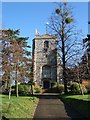
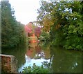
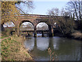
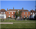
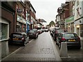
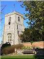
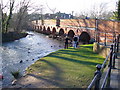
Photos of KT22 7LG

Area Information
Living in KT22 7LG offers a quiet, residential lifestyle in a small cluster of homes nestled in the English countryside. With a population of 1,883, the area is compact but well-served by nearby amenities and transport links. The community is characterised by a mature demographic, with a median age of 47 and a strong presence of adults aged 30–64. This suggests a stable, family-oriented environment where many residents are likely to have established careers and long-term ties to the area. The small size of KT22 7LG means it is not densely populated, offering a sense of space and privacy. While the area lacks large-scale urban features, its proximity to Leatherhead and surrounding towns provides access to broader services. Daily life here is likely to revolve around local shops, nearby rail stations, and the natural surroundings, making it appealing to those seeking a balanced lifestyle between rural tranquillity and commuter convenience.
- Area Type
- Postcode
- Area Size
- Not available
- Population
- 1883
- Population Density
- 3068 people/km²
The property market in KT22 7LG is predominantly owner-occupied, with 57% of homes owned by residents rather than rented. This reflects a stable, long-term housing stock, likely dominated by family homes. The accommodation type is primarily houses, which is typical for smaller, rural postcode areas. This suggests a market focused on individual properties rather than flats or apartments, appealing to buyers seeking space and privacy. The limited size of KT22 7LG means the housing stock is not extensive, but the proximity to larger towns like Leatherhead offers additional options for those seeking more variety. For buyers, this small area may present opportunities for investment in established homes, though the market is unlikely to be highly dynamic due to the low population density. The absence of rental-heavy properties indicates a community where homeownership is the norm, which can be a factor in property value stability.
House Prices in KT22 7LG
No properties found in this postcode.
Energy Efficiency in KT22 7LG
The lifestyle in KT22 7LG is shaped by its proximity to practical amenities. Nearby retail options include M&S Leatherhead BP, Morrisons Daily, and Lidl Leatherhead, offering everyday shopping needs within easy reach. The area’s railway stations provide access to broader leisure and employment opportunities, while the small residential cluster itself fosters a localised, community-focused environment. Although the data does not mention parks or recreational facilities, the absence of planning constraints like AONB or protected woodlands suggests open spaces may be available nearby. The combination of retail, transport, and quiet living makes KT22 7LG suitable for those valuing convenience without sacrificing rural character.
Amenities
Schools
The nearest school to KT22 7LG is Downsend School, Leatherhead Lodge, an independent institution. This type of school typically offers specialist education with smaller class sizes and tailored resources, though it does not provide Ofsted ratings in the data. The presence of an independent school suggests the area may attract families seeking alternative educational options, though it does not include state-funded schools. For families prioritising a range of school types, the limited data means additional research would be needed to confirm other nearby schools. The single listed school highlights the importance of proximity to larger towns like Leatherhead, where more educational options are likely available.
| Rank | School | Type | Entry gender | Ages |
|---|
Explore more schools in this area
Go to Schools tabDemographics
KT22 7LG has a median age of 47, with the majority of residents falling within the 30–64 age range. This indicates a mature, stable population, likely with strong family ties and long-term residency. Home ownership is high, at 57%, suggesting a community of property owners rather than renters. The predominant accommodation type is houses, which aligns with the area’s small, residential character. The dominant ethnic group is White, reflecting a homogenous demographic profile. While this data does not include specific figures on deprivation, the combination of high home ownership and a middle-aged population often correlates with lower deprivation levels. This suggests residents may have higher disposable income and access to services, though the small population size means the area’s economic profile is not heavily diversified. The absence of significant demographic diversity may appeal to those seeking a familiar, low-risk community.
Household Size
Accommodation Type
Tenure
Ethnic Group
Religion
Household Composition
Age
Household Deprivation
NS-SEC
Explore more demographic insights in this area
Go to Demographics tabPlanning
Planning Constraints
- Flood RiskPremium
- Ramsar Wetland SitesPremium
- Area of Outstanding Natural BeautyPremium
- Protected Nature ReservePremium
- Protected WoodlandPremium