Area Overview for KT22 7JN
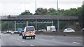
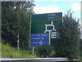
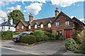
Photos of KT22 7JN


Area Information
KT22 7JN is a compact residential postcode area in England, covering just 3.9 hectares and home to 1,598 residents. Its high population density of 40,688 people per square kilometre reflects a tightly knit community, where proximity to amenities and services is a defining feature. The area’s small size means residents are likely to know their neighbours, fostering a sense of local cohesion. With a median age of 47 and a majority of residents aged 30–64, this is a mature community, often characterised by long-term homeownership. The presence of a single primary school and multiple rail stations within reach suggests a balance between suburban convenience and accessibility to urban hubs. Daily life here is likely shaped by routine commutes, family-oriented routines, and a reliance on nearby retail and transport networks. The area’s compact nature means that essential services are within walking or short driving distance, though its limited size may restrict options for larger properties or expansive green spaces. For those prioritising community connection and ease of access, KT22 7JN offers a focused, practical living environment.
- Area Type
- Postcode
- Area Size
- 3.9 hectares
- Population
- 1598
- Population Density
- 2412 people/km²
KT22 7JN is predominantly a home-ownership area, with 92% of properties owned by residents rather than rented. The accommodation type is exclusively houses, which is unusual for a small postcode area but may indicate a mix of semi-detached or terraced homes. This suggests a market where properties are likely to be family-sized, with gardens or outdoor space, catering to the area’s mature demographic. The high home ownership rate implies limited rental availability, which could make the area less attractive to younger buyers or those seeking short-term tenancies. Given the small size of the postcode, the housing stock is likely concentrated within a close radius, meaning buyers should consider nearby areas for more options. The presence of houses rather than flats or apartments also suggests a preference for traditional, low-density living, which may align with the community’s established character.
House Prices in KT22 7JN
No properties found in this postcode.
Energy Efficiency in KT22 7JN
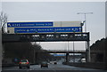
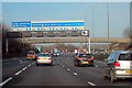
KT22 7JN offers a range of amenities within practical reach, including five retail outlets such as Morrisons Daily, Sainsburys Leatherhead, and M&S Leatherhead BP. These shops provide everyday essentials, from groceries to fuel, supporting a self-contained lifestyle. The nearby rail stations, including Leatherhead and Bookham, add to the area’s connectivity, enabling quick access to larger towns and cities. While the data does not specify parks or leisure facilities, the proximity to rail and retail suggests a focus on functional living rather than expansive recreational spaces. The combination of retail options and transport links means residents can meet daily needs without venturing far, though those seeking extensive green spaces or cultural amenities may need to look beyond the immediate area. The lifestyle here appears to prioritise convenience and accessibility over sprawling leisure options.
Amenities
Schools
The nearest school to KT22 7JN is St Peter’s Catholic Primary School, which holds an outstanding Ofsted rating. This indicates a high standard of education for younger children, with a focus on Catholic values. The absence of secondary schools in the immediate vicinity means families may need to look further afield for secondary education, though the primary school’s quality offers a strong foundation for early years. The single primary school suggests a limited choice for parents, but its outstanding rating may compensate by providing a reliable and well-regarded option. Given the area’s mature demographic, it is possible that many residents have children already in higher education or have completed their schooling, reducing the immediate demand for secondary-level institutions. The school’s presence also contributes to the area’s appeal for families prioritising quality primary education.
| Rank | School | Type | Entry gender | Ages |
|---|
Explore more schools in this area
Go to Schools tabDemographics
The demographic profile of KT22 7JN is defined by a median age of 47, with the largest age group being adults aged 30–64. This suggests a population skewed towards middle-aged individuals, likely including professionals, families, and retirees. Home ownership is exceptionally high at 92%, indicating a stable, long-term resident base with limited rental activity. The area is predominantly occupied by White residents, though specific data on other ethnic groups is not provided. The high proportion of homeowners and the age range of residents imply a community with established roots, where property values may reflect long-term investment. The absence of detailed data on deprivation or diversity means the area’s social dynamics are not fully quantified, but the high home ownership rate and mature age profile suggest a low turnover of residents and a focus on settled, family-oriented living.
Household Size
Accommodation Type
Tenure
Ethnic Group
Religion
Household Composition
Age
Household Deprivation
NS-SEC
Explore more demographic insights in this area
Go to Demographics tabPlanning
Planning Constraints
- Flood RiskPremium
- Ramsar Wetland SitesPremium
- Area of Outstanding Natural BeautyPremium
- Protected Nature ReservePremium
- Protected WoodlandPremium