Area Overview for KT22 7HZ
Photos of KT22 7HZ
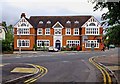
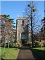
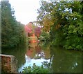
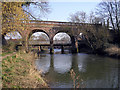
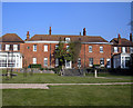
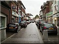
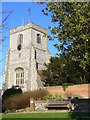
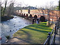
100 photos from this area
Area Information
Key information about the KT22 7HZ including its size, population, and administrative classification.
- Area Type
- Postcode
- Area Size
- 2.0 hectares
- Population
- 1883
- Population Density
- 3068 people/km²
House Prices in KT22 7HZ
17
Properties
£518,615
Average Sold Price
£182,500
Lowest Price
£1,025,000
Highest Price
Showing 17 properties
| Address | Type | Beds | Baths | Last Sale Price | Last Sale Date | |
|---|---|---|---|---|---|---|
| 12 Park Rise, Leatherhead, KT22 7HZ | Retail | 4 | 1 | £850,000 | Sep 2021 | |
| 6 Park Rise, Leatherhead, KT22 7HZ | Detached | 5 | 3 | £1,025,000 | Jun 2020 | |
| 7B Park Rise, Leatherhead, KT22 7HZ | Maisonette | 4 | 3 | £452,500 | Mar 2018 | |
| 7A Park Rise, Leatherhead, KT22 7HZ | Flat | - | - | £250,000 | Oct 2014 | |
| 11 Park Rise, Leatherhead, KT22 7HZ | Detached | 4 | - | £500,000 | Oct 2013 | |
| 1 Park Rise, Leatherhead, KT22 7HZ | house | 4 | - | £550,000 | May 2011 | |
| 8 Park Rise, Leatherhead, KT22 7HZ | house | 5 | - | £720,000 | Dec 2010 | |
| 9B Park Rise, Leatherhead, KT22 7HZ | Flat | - | - | £320,000 | Jun 2008 | |
| 14 Park Rise, Leatherhead, KT22 7HZ | Detached | - | - | £495,000 | Dec 2007 | |
| 2 Park Rise, Leatherhead, KT22 7HZ | Detached | - | - | £537,000 | Sep 2006 |
Page 1 of 2
Energy Efficiency in KT22 7HZ
Amenities
Schools
| Rank | School | Type | Entry gender | Ages |
|---|
Explore more schools in this area
Go to Schools tabDemographics
Household Size
One person
most common
Accommodation Type
Houses
most common
Tenure
57
majority
Ethnic Group
White
most common
Religion
N/A
most common
Household Composition
N/A
most common
Age
47
median
Adults (30-64 years)
most common
Household Deprivation
N/A
with no deprivation
NS-SEC
40
in Lower managerial occupations
Explore more demographic insights in this area
Go to Demographics tabPlanning
Planning Constraints
- Flood RiskPremium
- Ramsar Wetland SitesPremium
- Area of Outstanding Natural BeautyPremium
- Protected Nature ReservePremium
- Protected WoodlandPremium