Area Overview for KT22 0WZ
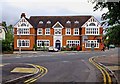
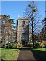
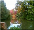
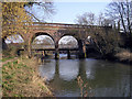
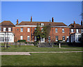
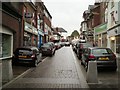
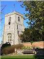
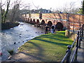
Photos of KT22 0WZ
Area Information
KT22 0WZ is a small residential postcode area in England, home to 1,815 people. Its compact size reflects a tightly knit community, with a focus on practical living. The area’s demographics suggest a mature population, with a median age of 47 and a majority of residents aged 30–64. This makes it a stable, family-oriented environment, though the low home ownership rate (46%) indicates a mix of renters and homeowners. The area is served by two primary schools, including Leatherhead Trinity School and Nursery, which holds a ‘good’ Ofsted rating. Nearby, residents have access to essential retail outlets like Lidl Leatherhead and Waitrose Leatherhead, as well as multiple railway stations. While the area lacks large-scale amenities, its proximity to transport links and local shops supports a convenient lifestyle. The absence of environmental constraints, such as protected woodlands or Areas of Outstanding Natural Beauty, means development is not restricted, though the high crime risk score of 27/100 warrants caution. For buyers, KT22 0WZ offers a quiet, compact living space with practical access to services, though its small size means limited options for expansion.
- Area Type
- Postcode
- Area Size
- Not available
- Population
- 1815
- Population Density
- Not available
KT22 0WZ is characterised by a low home ownership rate of 46%, indicating that the majority of properties are rented rather than owner-occupied. The accommodation type is predominantly flats, which aligns with the area’s compact, residential nature. This suggests a housing stock that prioritises density over spaciousness, likely catering to individuals or smaller households. The small size of the postcode means the property market is limited, with few options for buyers seeking larger homes or land. However, the presence of nearby railway stations and retail amenities may make the area attractive to those prioritising convenience over space. For buyers, the focus on flats and rental properties means competition for available homes could be high, particularly in a small area with limited expansion potential. The market is likely to appeal to those looking for a low-maintenance, centrally located property within a practical radius of services.
House Prices in KT22 0WZ
No properties found in this postcode.
Energy Efficiency in KT22 0WZ
The lifestyle in KT22 0WZ is defined by its proximity to essential retail and transport hubs. Nearby shops include Lidl Leatherhead, M&S Leatherhead BP, and Waitrose Leatherhead, offering a range of everyday goods and services. These retail options provide convenience for grocery shopping and other necessities. The area’s rail network, with stations such as Leatherhead and Ashtead, ensures easy access to regional destinations, supporting both commuting and leisure travel. While the data does not mention parks or leisure facilities, the presence of multiple railway stations and retail outlets suggests a focus on practicality over large-scale recreational amenities. The compact nature of the area means residents must travel slightly further for more extensive leisure options, but the immediate surroundings offer sufficient daily convenience. This balance of accessibility and small-scale living defines the lifestyle in KT22 0WZ.
Amenities
Schools
Residents of KT22 0WZ have access to two primary schools: The Woodville School and Leatherhead Trinity School and Nursery. The latter, which holds a ‘good’ Ofsted rating, provides a reliable option for younger children. The presence of two primary schools within the area offers families a choice, though no secondary schools are listed in the data. This suggests that students may need to travel to nearby areas for secondary education. The availability of a ‘good’-rated primary school is a positive factor for families prioritising early education, but the lack of secondary options could be a limitation for those seeking a full range of schooling within the postcode. The schools’ proximity to residential areas ensures ease of access, supporting a family-friendly environment in KT22 0WZ.
| Rank | School | Type | Entry gender | Ages |
|---|
Explore more schools in this area
Go to Schools tabDemographics
The population of KT22 0WZ is predominantly adults aged 30–64, reflecting a mature community with a median age of 47. Home ownership is relatively low at 46%, suggesting a significant proportion of residents rent their homes. The accommodation type is primarily flats, indicating a higher density of housing compared to detached properties. The predominant ethnic group is White, with no data provided on other demographics. The age profile and home ownership figures suggest a stable, long-term resident base, though the area’s small size may limit social diversity. The absence of specific data on deprivation means the quality of life cannot be fully assessed, but the presence of two primary schools and nearby retail hubs implies basic services are accessible. This demographic profile positions KT22 0WZ as a place for established individuals or families seeking a low-maintenance, community-focused environment.
Household Size
Accommodation Type
Tenure
Ethnic Group
Religion
Household Composition
Age
Household Deprivation
NS-SEC
Explore more demographic insights in this area
Go to Demographics tabPlanning
Planning Constraints
- Flood RiskPremium
- Ramsar Wetland SitesPremium
- Area of Outstanding Natural BeautyPremium
- Protected Nature ReservePremium
- Protected WoodlandPremium
- Crime RiskPremium