Area Overview for KT22 0WD
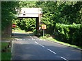
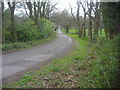
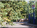
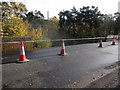
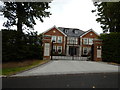
Photos of KT22 0WD
Area Information
KT22 0WD is a small, tightly packed residential cluster in England, home to 1,804 people spread across 6.1 km², giving it a population density of 295 people per square kilometre. This is a quiet, low-density area where daily life is shaped by its compact size and proximity to nearby amenities. The community is predominantly composed of adults aged 30–64, with a median age of 47, suggesting a stable, established population. Most residents own their homes, with 84% of properties in private ownership, and the area is characterised by a mix of houses rather than flats. Living here means a slower pace of life, with easy access to nearby rail stations, retail hubs, and natural waterways. While the area is small, it offers a balance of convenience and tranquillity, making it appealing to those seeking a settled, community-focused lifestyle.
- Area Type
- Postcode
- Area Size
- Not available
- Population
- 1804
- Population Density
- 295 people/km²
KT22 0WD is a largely owner-occupied area, with 84% of properties in private hands. The accommodation type is predominantly houses, which is typical of smaller, residential postcode clusters. This suggests a market where property values are likely to be more stable, as owner-occupation tends to reduce rental demand. The limited size of the area means that the housing stock is relatively small, so buyers may find fewer options compared to larger towns. However, the presence of nearby amenities and transport links could make the area attractive to those seeking a quiet, established home. For buyers, the focus is on individual properties rather than larger developments, with a clear emphasis on residential living.
House Prices in KT22 0WD
No properties found in this postcode.
Energy Efficiency in KT22 0WD
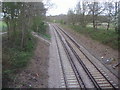
Living in KT22 0WD offers access to a range of amenities within easy reach. Retail options include M&S Rushett Chessington BP, Co-op Claygate, and Tesco Leatherhead, providing convenience for shopping and daily essentials. For leisure, nearby ferry landings such as Ditton Island Ferry Landing and Kingston Town End Pier offer water-based activities and scenic routes. While the area is small, its proximity to these amenities means residents can enjoy both practical and recreational opportunities without long commutes. The mix of retail, transport, and water-based access contributes to a lifestyle that balances convenience with a sense of community.
Amenities
Schools
The nearest school to KT22 0WD is Danes Hill School, an independent institution. This provides families with a private education option, though no other schools are listed in the data. The absence of state schools suggests that the area may cater to households seeking independent education, which can be a significant factor for families prioritising specific curricula or facilities. However, the limited school options mean that parents should consider the availability of alternative educational institutions nearby. Danes Hill School’s presence adds to the area’s appeal for those valuing private schooling, though it does not indicate a broader range of educational choices.
| Rank | School | Type | Entry gender | Ages |
|---|
Explore more schools in this area
Go to Schools tabDemographics
The population of KT22 0WD is predominantly adults aged 30–64, with a median age of 47. This suggests a mature, stable community with a strong presence of middle-aged residents. Home ownership is high, at 84%, indicating a long-term commitment to the area. The accommodation type is primarily houses, which aligns with the residential character of the postcode. The predominant ethnic group is White, reflecting the broader demographic trends in the region. With a population density of 295 people per km², the area is neither overcrowded nor sparse, offering a sense of space without isolation. The age profile and ownership rates suggest a community focused on family stability and long-term living, with fewer transient residents.
Household Size
Accommodation Type
Tenure
Ethnic Group
Religion
Household Composition
Age
Household Deprivation
NS-SEC
Explore more demographic insights in this area
Go to Demographics tabPlanning
Planning Constraints
- Flood RiskPremium
- Ramsar Wetland SitesPremium
- Area of Outstanding Natural BeautyPremium
- Protected Nature ReservePremium
- Protected WoodlandPremium