Area Overview for KT21 2TW
Photos of KT21 2TW
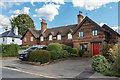
37 photos from this area
Area Information
Key information about the KT21 2TW including its size, population, and administrative classification.
- Area Type
- Postcode
- Area Size
- 1.8 hectares
- Population
- 1875
- Population Density
- 1897 people/km²
House Prices in KT21 2TW
14
Properties
£656,938
Average Sold Price
£352,000
Lowest Price
£880,000
Highest Price
Showing 14 properties
| Address | Type | Beds | Baths | Last Sale Price | Last Sale Date | |
|---|---|---|---|---|---|---|
| 3A Leatherhead Road, Ashtead, KT21 2TW | Bungalow | 4 | 2 | £775,000 | Apr 2024 | |
| 9 Leatherhead Road, Ashtead, KT21 2TW | house | - | - | £605,500 | Aug 2022 | |
| 5 Leatherhead Road, Ashtead, KT21 2TW | house | - | - | £747,500 | Sep 2021 | |
| 1A Leatherhead Road, Ashtead, KT21 2TW | Detached | 4 | 2 | £780,000 | Sep 2020 | |
| 11 Leatherhead Road, Ashtead, KT21 2TW | Bungalow | - | - | £695,000 | Jul 2020 | |
| Inwood, 23 Leatherhead Road, Ashtead, KT21 2TW | Detached | 5 | 3 | £880,000 | Apr 2018 | |
| 19 Leatherhead Road, Ashtead, KT21 2TW | Semi-detached | 4 | 1 | £612,750 | Feb 2018 | |
| Silver Firs, 7A Leatherhead Road, Ashtead, KT21 2TW | house | - | - | £743,000 | Aug 2016 | |
| 15 Leatherhead Road, Ashtead, KT21 2TW | Terraced | 3 | - | £460,000 | Apr 2013 | |
| 5A Leatherhead Road, Ashtead, KT21 2TW | Detached | - | - | £880,000 | Oct 2007 |
Page 1 of 2
Energy Efficiency in KT21 2TW
Amenities
Schools
| Rank | School | Type | Entry gender | Ages |
|---|
Explore more schools in this area
Go to Schools tabDemographics
Household Size
Family (3-5 people)
most common
Accommodation Type
Houses
most common
Tenure
84
majority
Ethnic Group
White
most common
Religion
N/A
most common
Household Composition
N/A
most common
Age
47
median
Adults (30-64 years)
most common
Household Deprivation
N/A
with no deprivation
NS-SEC
52
in Lower managerial occupations
Explore more demographic insights in this area
Go to Demographics tabPlanning
Planning Constraints
- Flood RiskPremium
- Ramsar Wetland SitesPremium
- Area of Outstanding Natural BeautyPremium
- Protected Nature ReservePremium
- Protected WoodlandPremium