Area Overview for KT21 2HU
Photos of KT21 2HU


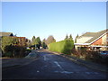
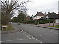
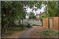
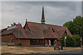
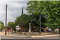
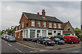
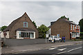
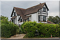
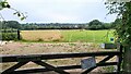
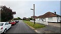
52 photos from this area
Area Information
Key information about the KT21 2HU including its size, population, and administrative classification.
- Area Type
- Postcode
- Area Size
- 1.4 hectares
- Population
- 1277
- Population Density
- 434 people/km²
House Prices in KT21 2HU
12
Properties
£393,188
Average Sold Price
£135,000
Lowest Price
£690,000
Highest Price
Showing 12 properties
| Address | Type | Beds | Baths | Last Sale Price | Last Sale Date | |
|---|---|---|---|---|---|---|
| 12 Miena Way, Ashtead, KT21 2HU | Bungalow | 3 | 2 | £690,000 | Apr 2022 | |
| 4 Miena Way, Ashtead, KT21 2HU | Detached | 4 | 2 | £650,000 | Feb 2020 | |
| 5 Miena Way, Ashtead, KT21 2HU | Detached | 4 | - | £575,000 | Feb 2017 | |
| 3 Miena Way, Ashtead, KT21 2HU | Detached | 4 | 2 | £327,500 | Jun 2009 | |
| 8 Miena Way, Ashtead, KT21 2HU | Detached | - | - | £358,000 | Sep 2004 | |
| 1 Miena Way, Ashtead, KT21 2HU | Bungalow | - | - | £235,000 | May 2000 | |
| 11 Miena Way, Ashtead, KT21 2HU | Detached | - | - | £175,000 | Jan 1999 | |
| 6 Miena Way, Ashtead, KT21 2HU | Detached | - | - | £135,000 | Oct 1995 | |
| The Cabin, 2 Miena Way, Ashtead, KT21 2HU | Bungalow | - | - | - | - | |
| 10 Miena Way, Ashtead, KT21 2HU | Bungalow | 3 | 2 | - | - |
Page 1 of 2
Energy Efficiency in KT21 2HU
Amenities
Schools
| Rank | School | Type | Entry gender | Ages |
|---|
Explore more schools in this area
Go to Schools tabDemographics
Household Size
Family (3-5 people)
most common
Accommodation Type
Houses
most common
Tenure
83
majority
Ethnic Group
White
most common
Religion
N/A
most common
Household Composition
N/A
most common
Age
47
median
Adults (30-64 years)
most common
Household Deprivation
N/A
with no deprivation
NS-SEC
52
in Lower managerial occupations
Explore more demographic insights in this area
Go to Demographics tabPlanning
Planning Constraints
- Flood RiskPremium
- Ramsar Wetland SitesPremium
- Area of Outstanding Natural BeautyPremium
- Protected Nature ReservePremium
- Protected WoodlandPremium