Area Overview for KT21 2BS
Photos of KT21 2BS
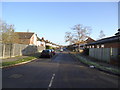
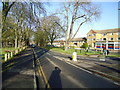
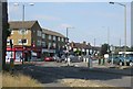
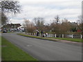
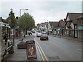
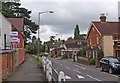
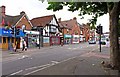
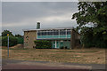
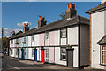
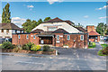
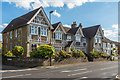
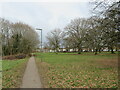
52 photos from this area
Area Information
Key information about the KT21 2BS including its size, population, and administrative classification.
- Area Type
- Postcode
- Area Size
- 9978 m²
- Population
- 1493
- Population Density
- 3529 people/km²
House Prices in KT21 2BS
22
Properties
£441,300
Average Sold Price
£132,500
Lowest Price
£1,155,000
Highest Price
Showing 22 properties
| Address | Type | Beds | Baths | Last Sale Price | Last Sale Date | |
|---|---|---|---|---|---|---|
| 76 Woodfield Lane, Ashtead, KT21 2BS | Cottage | 1 | 1 | £335,000 | Oct 2024 | |
| 62 Woodfield Lane, Ashtead, KT21 2BS | Detached | 5 | 3 | £1,050,000 | Sep 2024 | |
| Woodfield Cottages, 80 Woodfield Lane, Ashtead, KT21 2BS | Terraced | 1 | 1 | £280,000 | May 2023 | |
| 56 Woodfield Lane, Ashtead, KT21 2BS | house | 6 | 4 | £1,155,000 | Jan 2023 | |
| 54 Woodfield Lane, Ashtead, KT21 2BS | Semi-detached | 2 | 1 | £835,000 | Jun 2021 | |
| 74 Woodfield Lane, Ashtead, KT21 2BS | Terraced | 1 | 1 | £255,000 | Oct 2020 | |
| 66 Woodfield Lane, Ashtead, KT21 2BS | house | 4 | 2 | £650,000 | Apr 2014 | |
| 82 Woodfield Lane, Ashtead, KT21 2BS | Semi-detached | 3 | 2 | £350,000 | Aug 2008 | |
| 68 Woodfield Lane, Ashtead, KT21 2BS | Semi-detached | 2 | - | £135,400 | Feb 2007 | |
| 72 Woodfield Lane, Ashtead, KT21 2BS | Terraced | - | - | £175,000 | Jul 2006 |
Page 1 of 3
Energy Efficiency in KT21 2BS
Amenities
Schools
| Rank | School | Type | Entry gender | Ages |
|---|
Explore more schools in this area
Go to Schools tabDemographics
Household Size
Family (3-5 people)
most common
Accommodation Type
Houses
most common
Tenure
77
majority
Ethnic Group
White
most common
Religion
N/A
most common
Household Composition
N/A
most common
Age
47
median
Adults (30-64 years)
most common
Household Deprivation
N/A
with no deprivation
NS-SEC
48
in Lower managerial occupations
Explore more demographic insights in this area
Go to Demographics tabPlanning
Planning Constraints
- Flood RiskPremium
- Ramsar Wetland SitesPremium
- Area of Outstanding Natural BeautyPremium
- Protected Nature ReservePremium
- Protected WoodlandPremium