Area Overview for KT21 1SG
Photos of KT21 1SG
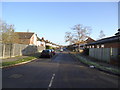
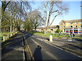
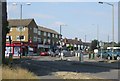
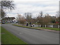
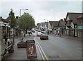
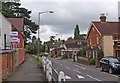
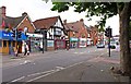
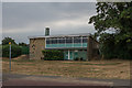
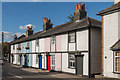
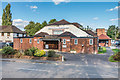
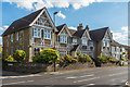
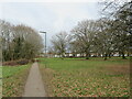
52 photos from this area
Area Information
Key information about the KT21 1SG including its size, population, and administrative classification.
- Area Type
- Postcode
- Area Size
- 2.5 hectares
- Population
- 1493
- Population Density
- 3529 people/km²
House Prices in KT21 1SG
53
Properties
£346,875
Average Sold Price
£78,500
Lowest Price
£682,500
Highest Price
Showing 53 properties
| Address | Type | Beds | Baths | Last Sale Price | Last Sale Date | |
|---|---|---|---|---|---|---|
| 94 Berry Meade, Ashtead, KT21 1SG | Terraced | 2 | 2 | £590,000 | May 2023 | |
| 46 Berry Meade, Ashtead, KT21 1SG | house | 3 | 1 | £682,500 | Oct 2022 | |
| 98 Berry Meade, Ashtead, KT21 1SG | house | 3 | 2 | £663,300 | Sep 2022 | |
| 70 Berry Meade, Ashtead, KT21 1SG | Semi-detached | 2 | 1 | £562,500 | Jun 2021 | |
| 86 Berry Meade, Ashtead, KT21 1SG | house | 2 | - | £420,000 | Dec 2020 | |
| 100 Berry Meade, Ashtead, KT21 1SG | Semi-detached | 3 | 1 | £527,500 | Jan 2018 | |
| 106 Berry Meade, Ashtead, KT21 1SG | Semi-detached | 3 | 3 | £505,000 | Jun 2016 | |
| 36 Berry Meade, Ashtead, KT21 1SG | Bungalow | 3 | - | £405,000 | Dec 2013 | |
| 26 Berry Meade, Ashtead, KT21 1SG | house | 3 | - | £349,950 | Sep 2010 | |
| 76 Berry Meade, Ashtead, KT21 1SG | Semi-detached | 2 | 1 | £222,000 | Jul 2008 |
Page 1 of 6
Energy Efficiency in KT21 1SG
Amenities
Schools
| Rank | School | Type | Entry gender | Ages |
|---|
Explore more schools in this area
Go to Schools tabDemographics
Household Size
Family (3-5 people)
most common
Accommodation Type
Houses
most common
Tenure
77
majority
Ethnic Group
White
most common
Religion
N/A
most common
Household Composition
N/A
most common
Age
47
median
Adults (30-64 years)
most common
Household Deprivation
N/A
with no deprivation
NS-SEC
48
in Lower managerial occupations
Explore more demographic insights in this area
Go to Demographics tabPlanning
Planning Constraints
- Flood RiskPremium
- Ramsar Wetland SitesPremium
- Area of Outstanding Natural BeautyPremium
- Protected Nature ReservePremium
- Protected WoodlandPremium