Area Overview for KT21 1DL
Photos of KT21 1DL
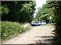
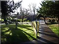
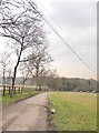
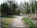
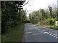
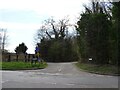
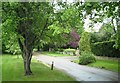
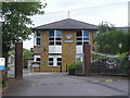
23 photos from this area
Area Information
Key information about the KT21 1DL including its size, population, and administrative classification.
- Area Type
- Postcode
- Area Size
- 12.3 hectares
- Population
- 1444
- Population Density
- 385 people/km²
House Prices in KT21 1DL
36
Properties
£927,575
Average Sold Price
£249,500
Lowest Price
£1,705,000
Highest Price
Showing 36 properties
| Address | Type | Beds | Baths | Last Sale Price | Last Sale Date | |
|---|---|---|---|---|---|---|
| 32 Oaken Coppice, Ashtead, KT21 1DL | Detached | 4 | 2 | £1,500,000 | Mar 2025 | |
| 27 Oaken Coppice, Ashtead, KT21 1DL | Detached | 5 | 3 | £1,600,000 | Apr 2023 | |
| The Lodge, 34 Oaken Coppice, Ashtead, KT21 1DL | Retail | 3 | 3 | £1,705,000 | Sep 2022 | |
| Braeside, Oaken Coppice, Ashtead, KT21 1DL | Retail | 4 | 2 | £1,340,000 | Feb 2022 | |
| 2 Oaken Coppice, Ashtead, KT21 1DL | house | - | - | £1,230,000 | Dec 2019 | |
| 22 Oaken Coppice, Ashtead, KT21 1DL | Detached | 4 | 3 | £1,142,000 | Aug 2018 | |
| Oaken Coppice House, 29 Oaken Coppice, Ashtead, KT21 1DL | house | - | - | £1,400,000 | Jun 2015 | |
| Orchard End, Oaken Coppice, Ashtead, KT21 1DL | Detached | - | - | £850,000 | Oct 2007 | |
| 15 Oaken Coppice, Ashtead, KT21 1DL | Detached | - | - | £925,000 | Nov 2006 | |
| 20 Oaken Coppice, Ashtead, KT21 1DL | Detached | - | - | £935,000 | Apr 2006 |
Page 1 of 4
Energy Efficiency in KT21 1DL
Amenities
Schools
| Rank | School | Type | Entry gender | Ages |
|---|
Explore more schools in this area
Go to Schools tabDemographics
Household Size
Family (3-5 people)
most common
Accommodation Type
Houses
most common
Tenure
90
majority
Ethnic Group
White
most common
Religion
N/A
most common
Household Composition
N/A
most common
Age
47
median
Adults (30-64 years)
most common
Household Deprivation
N/A
with no deprivation
NS-SEC
56
in Lower managerial occupations
Explore more demographic insights in this area
Go to Demographics tabPlanning
Planning Constraints
- Flood RiskPremium
- Ramsar Wetland SitesPremium
- Area of Outstanding Natural BeautyPremium
- Protected Nature ReservePremium
- Protected WoodlandPremium