Area Overview for KT20 6TU
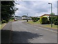
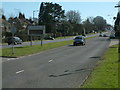
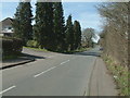
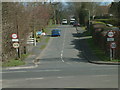
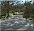
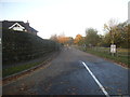
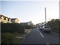
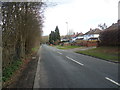
Photos of KT20 6TU


Area Information
KT20 6TU represents a small, defined residential cluster within the Basildon and Castle Hill locality. This postcode covers an area of 1,936 square metres and serves a population of 1,890 residents. Living in KT20 6TU means occupying a tightly knit neighbourhood where every street corner is familiar to long-term inhabitants. The physical scale of this cluster ensures that distances between homes, shops, and transport links remain short and manageable. You will find a dense concentration of dwellings without the sprawling urban footprint typical of larger districts. The environment reflects a settled, established community rather than a rapidly developing zone. Daily life here involves navigating a compact landscape where local services are within easy walking or cycling distance. This specific postcode acts as the central hub for the surrounding households, providing a stable foundation for those seeking a grounded address. The low population density relative to the total area suggests sufficient green space and outdoor areas for residents to enjoy. Those considering buying in KT20 6TU are acquiring a property in a location known for its stability and clear boundaries. The area stands apart from larger towns by maintaining a distinct, manageable character. Every resident benefits from the proximity to the station and local retail units. This makes it a practical choice for families and professionals who value convenience alongside a residential atmosphere.
- Area Type
- Postcode
- Area Size
- 1936 m²
- Population
- 1890
- Population Density
- 398 people/km²
The housing market within KT20 6TU reflects a settled, owner-occupied environment. A high proportion of residents, specifically 88%, own their homes. This starkly contrasts with rental-heavy areas where tenant turnover frequently disrupts neighbourhood stability. The predominant accommodation type consists of houses, which are likely detached, semi-detached, or terraced family homes rather than apartment blocks. This housing style suits the demographic profile of adults aged 30 to 64 and families with children. Buyers looking at this specific postcode will find a stock designed for permanent living rather than investment flipping. The low density of the 1,936 square metre area implies a scarcity of large developments. Instead, the property market operates on the principle of individual house sales. Homeowners in KT20 6TU have made significant commitments to these properties, suggesting strong connections to the ground and local schools. The high ownership rate often results in competitive properties that are better maintained and respected. Prospective buyers can expect a residential atmosphere free from the noise and congestion of high-rise blocks. The mix of house types supports various family sizes but excludes those seeking city-style urban flats. This market orientation means disposable income often goes toward house improvements rather than renting. You will find a community where standing on your doorstep feels like home, reinforcing the decision to settle down permanently. The local estate focus remains on single-family dwellings that integrate seamlessly with the surroundings.
House Prices in KT20 6TU
Showing 2 properties
| Address | Type | Beds | Baths | Last Sale Price | Last Sale Date | |
|---|---|---|---|---|---|---|
| Treetops, 2 Smithy Close, Lower Kingswood, KT20 6TU | house | - | - | £490,000 | Sep 2014 | |
| Anvil House, 1 Smithy Close, Lower Kingswood, KT20 6TU | Detached | 3 | 2 | £360,000 | Jun 2004 |
Energy Efficiency in KT20 6TU
Living in KT20 6TU offers convenient access to essential retail and transport links within practical reach. Residents have five retail options nearby, including M&S Oak Tree Lwr Kingswood BP and The Southern Co-operative Co. These specific venues provide daily necessities without requiring a long drive to the town centre. Shopping trips to the Co-op Walton or the Southern Co-operative Co fit easily into a morning or afternoon routine. Five rail connections serve the immediate vicinity, ensuring easy access to wider networks. Kingswood Railway Station is the closest hub, followed closely by Tadworth Railway Station and Reigate Railway Station. This breadth of rail access allows you to commute to Reigate or London with minimal urgency. The proximity of these stations means that travel time to key employment centres remains competitive. For those without a car, the combination of local shops and multiple rail stations creates a self-sufficient lifestyle. You do not need to venture far to stock up on groceries or catch a train. The Southern Co-operative Co and M&S serve as anchor points for the local shopping culture. Children can ride their bikes to Kingswood Railway Station or reach the retail outlets with ease. This direct access to transport and retail defines the everyday rhythm of life in KT20 6TU. The area functions efficiently because these key services are so close to every home.
Amenities
Schools
Schooling options for children in KT20 6TU are represented by a mix of state and independent special provisions. Kingswood Primary School stands as a key local institution for younger children. It serves the community as a comprehensive primary education provider. Nearby, Merrywood House Independent Special School offers specialist education for children with additional needs. This school holds an outstanding Ofsted rating, indicating a high standard of care and instruction within its framework. While Kingswood Primary is noted more than once in local listings, it remains the primary general education option. The presence of an outstanding-rated special school adds a layer of expertise to the local educational landscape. Families with specific educational requirements have secure local access without needing long-distance travel. The combination of a standard primary school and a highly rated special school creates a supportive environment for diverse learning needs. When considering schools near KT20 6TU, you will find that the local provision caters not only to mainstream education but also to special needs. This variety ensures that every child, regardless of their learning profile, has a suitable nearby institution. The quality rating of Merrywood House Independent Special School provides reassurance for parents seeking the very best for their children.
| Rank | School | Type | Entry gender | Ages |
|---|
Explore more schools in this area
Go to Schools tabDemographics
The community character in KT20 6TU is defined by a mature demographic profile. The median age of 47 years indicates a neighbourhood dominated by families and established residents rather than young professionals or students. Most commonly, the population consists of adults between 30 and 64 years old. This age distribution supports schools and local amenities that cater to children and growing families. Home ownership is extremely high, with 88% of households owned outright or with a mortgage. This figure signals a settled market where residents have deep roots in the locality rather than transient occupancy. The predominant accommodation type is houses, which aligns with the preference of older children and larger families over urban flats. Customer diversity is primarily White, reflecting the established nature of the settlement. There are no significant demographic shifts suggesting rapid change or influxes of new populations. The high rate of home ownership suggests strong attachment to the local community and stability in the housing stock. For those analysing the area, the lack of rental dominance points to a neighbourhood where people stay long-term. The age range of the majority population implies a need for family-friendly infrastructure and safe play areas. You are looking at an area where multi-generational families have built their lives over many years. This stability often correlates with well-maintained properties and engaged residents who protect the neighbourhood's reputation.
Household Size
Accommodation Type
Tenure
Ethnic Group
Religion
Household Composition
Age
Household Deprivation
NS-SEC
Explore more demographic insights in this area
Go to Demographics tabPlanning
Planning Constraints
- Flood RiskPremium
- Ramsar Wetland SitesPremium
- Area of Outstanding Natural BeautyPremium
- Protected Nature ReservePremium
- Protected WoodlandPremium