Area Overview for KT20 6RD
Photos of KT20 6RD

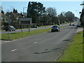


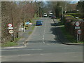


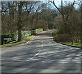
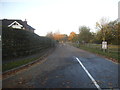
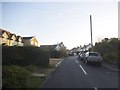
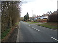
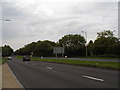
28 photos from this area
Area Information
Key information about the KT20 6RD including its size, population, and administrative classification.
- Area Type
- Postcode
- Area Size
- 5.0 hectares
- Population
- 1716
- Population Density
- 828 people/km²
House Prices in KT20 6RD
29
Properties
£410,647
Average Sold Price
£86,000
Lowest Price
£850,000
Highest Price
Showing 29 properties
| Address | Type | Beds | Baths | Last Sale Price | Last Sale Date | |
|---|---|---|---|---|---|---|
| 73 Chipstead Lane, Lower Kingswood, KT20 6RD | house | - | - | £850,000 | Aug 2022 | |
| 85 Chipstead Lane, Lower Kingswood, KT20 6RD | house | - | - | £505,000 | Feb 2021 | |
| 55 Chipstead Lane, Lower Kingswood, KT20 6RD | house | - | - | £521,100 | Jan 2021 | |
| 49 Chipstead Lane, Lower Kingswood, KT20 6RD | Semi-detached | 3 | 1 | £545,000 | Nov 2020 | |
| 87 Chipstead Lane, Lower Kingswood, KT20 6RD | Semi-detached | 3 | 1 | £550,000 | Jun 2019 | |
| 59 Chipstead Lane, Lower Kingswood, KT20 6RD | Semi-detached | 3 | 1 | £485,000 | May 2019 | |
| 75 Chipstead Lane, Lower Kingswood, KT20 6RD | Semi-detached | 4 | - | £525,000 | May 2019 | |
| 69 Chipstead Lane, Lower Kingswood, KT20 6RD | Semi-detached | 4 | 1 | £495,000 | Feb 2019 | |
| 63 Chipstead Lane, Lower Kingswood, KT20 6RD | Semi-detached | 5 | 3 | £515,000 | May 2018 | |
| 53 Chipstead Lane, Lower Kingswood, KT20 6RD | Semi-detached | 3 | 1 | £485,000 | Aug 2015 |
Page 1 of 3
Energy Efficiency in KT20 6RD
Amenities
Schools
| Rank | School | Type | Entry gender | Ages |
|---|
Explore more schools in this area
Go to Schools tabDemographics
Household Size
Family (3-5 people)
most common
Accommodation Type
Houses
most common
Tenure
85
majority
Ethnic Group
White
most common
Religion
N/A
most common
Household Composition
N/A
most common
Age
47
median
Adults (30-64 years)
most common
Household Deprivation
N/A
with no deprivation
NS-SEC
37
in Lower managerial occupations
Explore more demographic insights in this area
Go to Demographics tabPlanning
Planning Constraints
- Flood RiskPremium
- Ramsar Wetland SitesPremium
- Area of Outstanding Natural BeautyPremium
- Protected Nature ReservePremium
- Protected WoodlandPremium