Area Overview for KT20 6DA
Photos of KT20 6DA
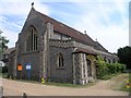
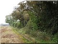
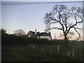
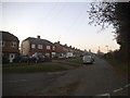
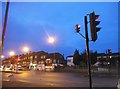
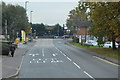
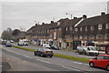
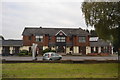
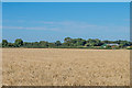
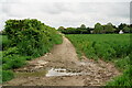
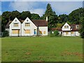
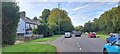
36 photos from this area
Area Information
Key information about the KT20 6DA including its size, population, and administrative classification.
- Area Type
- Postcode
- Area Size
- 4.5 hectares
- Population
- 1856
- Population Density
- 402 people/km²
House Prices in KT20 6DA
41
Properties
£339,766
Average Sold Price
£84,000
Lowest Price
£577,000
Highest Price
Showing 41 properties
| Address | Type | Beds | Baths | Last Sale Price | Last Sale Date | |
|---|---|---|---|---|---|---|
| 1 Ballards Green, Burgh Heath, KT20 6DA | Detached | 2 | 1 | £114,980 | May 2024 | |
| 31 Ballards Green, Burgh Heath, KT20 6DA | house | - | - | £550,000 | Sep 2022 | |
| 10 Ballards Green, Burgh Heath, KT20 6DA | house | 4 | 1 | £577,000 | Jun 2022 | |
| 2 Ballards Green, Burgh Heath, KT20 6DA | Retail | 2 | 2 | £475,000 | Feb 2022 | |
| 28 Ballards Green, Burgh Heath, KT20 6DA | house | 4 | 2 | £525,000 | Jun 2021 | |
| 14 Ballards Green, Burgh Heath, KT20 6DA | house | - | - | £500,000 | Jan 2021 | |
| 4 Ballards Green, Burgh Heath, KT20 6DA | Bungalow | 4 | 2 | £525,000 | Jan 2021 | |
| 24 Ballards Green, Burgh Heath, KT20 6DA | house | - | - | £495,000 | Oct 2020 | |
| 48 Ballards Green, Burgh Heath, KT20 6DA | Semi-detached | 4 | 1 | £510,000 | May 2020 | |
| 3 Ballards Green, Burgh Heath, KT20 6DA | Detached | 2 | 1 | £460,000 | May 2020 |
Page 1 of 5
Energy Efficiency in KT20 6DA
Amenities
Schools
| Rank | School | Type | Entry gender | Ages |
|---|
Explore more schools in this area
Go to Schools tabDemographics
Household Size
Two person
most common
Accommodation Type
Houses
most common
Tenure
77
majority
Ethnic Group
White
most common
Religion
N/A
most common
Household Composition
N/A
most common
Age
47
median
Adults (30-64 years)
most common
Household Deprivation
N/A
with no deprivation
NS-SEC
45
in Lower managerial occupations
Explore more demographic insights in this area
Go to Demographics tabPlanning
Planning Constraints
- Flood RiskPremium
- Ramsar Wetland SitesPremium
- Area of Outstanding Natural BeautyPremium
- Protected Nature ReservePremium
- Protected WoodlandPremium