Area Overview for KT20 5JS
Photos of KT20 5JS
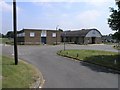
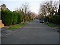
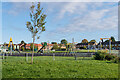
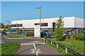

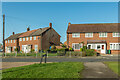
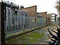
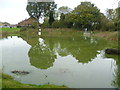
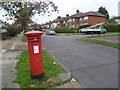
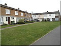
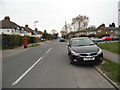
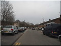
31 photos from this area
Area Information
Key information about the KT20 5JS including its size, population, and administrative classification.
- Area Type
- Postcode
- Area Size
- 5.4 hectares
- Population
- 1856
- Population Density
- 402 people/km²
House Prices in KT20 5JS
40
Properties
£234,005
Average Sold Price
£62,000
Lowest Price
£450,000
Highest Price
Showing 40 properties
| Address | Type | Beds | Baths | Last Sale Price | Last Sale Date | |
|---|---|---|---|---|---|---|
| 28 Hatch Gardens, Tadworth, KT20 5JS | Terraced | 3 | 1 | £450,000 | Mar 2025 | |
| 26 Hatch Gardens, Tadworth, KT20 5JS | Terraced | 2 | 1 | £415,000 | Mar 2025 | |
| 78 Hatch Gardens, Tadworth, KT20 5JS | Terraced | 3 | 1 | £382,500 | Apr 2024 | |
| 6 Hatch Gardens, Tadworth, KT20 5JS | Terraced | 3 | 1 | £378,000 | Jun 2022 | |
| 80 Hatch Gardens, Tadworth, KT20 5JS | Terraced | 2 | 1 | £230,000 | Sep 2021 | |
| 32 Hatch Gardens, Tadworth, KT20 5JS | Terraced | 2 | 1 | £350,000 | Feb 2020 | |
| 14 Hatch Gardens, Tadworth, KT20 5JS | Terraced | 3 | 1 | £350,000 | Feb 2018 | |
| 10 Hatch Gardens, Tadworth, KT20 5JS | house | - | - | £310,000 | Jun 2017 | |
| 64 Hatch Gardens, Tadworth, KT20 5JS | Terraced | 3 | - | £233,000 | Aug 2013 | |
| 56 Hatch Gardens, Tadworth, KT20 5JS | Terraced | 3 | - | £213,000 | May 2012 |
Page 1 of 4
Energy Efficiency in KT20 5JS
Amenities
Schools
| Rank | School | Type | Entry gender | Ages |
|---|
Explore more schools in this area
Go to Schools tabDemographics
Household Size
Two person
most common
Accommodation Type
Houses
most common
Tenure
77
majority
Ethnic Group
White
most common
Religion
N/A
most common
Household Composition
N/A
most common
Age
47
median
Adults (30-64 years)
most common
Household Deprivation
N/A
with no deprivation
NS-SEC
45
in Lower managerial occupations
Explore more demographic insights in this area
Go to Demographics tabPlanning
Planning Constraints
- Flood RiskPremium
- Ramsar Wetland SitesPremium
- Area of Outstanding Natural BeautyPremium
- Protected Nature ReservePremium
- Protected WoodlandPremium