Area Overview for KT19 9PG
Photos of KT19 9PG
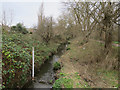


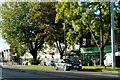
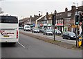
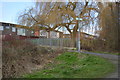
57 photos from this area
Area Information
Key information about the KT19 9PG including its size, population, and administrative classification.
- Area Type
- Postcode
- Area Size
- 1.1 hectares
- Population
- 1625
- Population Density
- 7594 people/km²
House Prices in KT19 9PG
35
Properties
£360,342
Average Sold Price
£219,950
Lowest Price
£515,000
Highest Price
Showing 35 properties
| Address | Type | Beds | Baths | Last Sale Price | Last Sale Date | |
|---|---|---|---|---|---|---|
| 40 Holman Road, West Ewell, KT19 9PG | Terraced | 3 | 1 | £515,000 | Dec 2025 | |
| 46 Holman Road, West Ewell, KT19 9PG | house | - | - | £425,000 | Sep 2023 | |
| 48 Holman Road, West Ewell, KT19 9PG | house | - | - | £445,000 | May 2021 | |
| 36 Holman Road, West Ewell, KT19 9PG | Terraced | 3 | - | £427,000 | Mar 2021 | |
| 58 Holman Road, West Ewell, KT19 9PG | house | - | - | £420,000 | Mar 2021 | |
| 31 Holman Road, West Ewell, KT19 9PG | Maisonette | - | - | £320,000 | Jan 2020 | |
| 42 Holman Road, West Ewell, KT19 9PG | Semi-detached | 3 | 1 | £415,000 | Jul 2019 | |
| 43 Holman Road, West Ewell, KT19 9PG | Maisonette | 2 | 1 | £335,000 | Nov 2018 | |
| 38 Holman Road, West Ewell, KT19 9PG | Terraced | 3 | 2 | £360,000 | Oct 2018 | |
| 49 Holman Road, West Ewell, KT19 9PG | Terraced | 3 | - | £355,000 | Feb 2017 |
Page 1 of 4
Energy Efficiency in KT19 9PG
Amenities
Schools
| Rank | School | Type | Entry gender | Ages |
|---|
Explore more schools in this area
Go to Schools tabDemographics
Household Size
Family (3-5 people)
most common
Accommodation Type
Houses
most common
Tenure
44
majority
Ethnic Group
White
most common
Religion
N/A
most common
Household Composition
N/A
most common
Age
47
median
Adults (30-64 years)
most common
Household Deprivation
N/A
with no deprivation
NS-SEC
25
in Lower managerial occupations
Explore more demographic insights in this area
Go to Demographics tabPlanning
Planning Constraints
- Flood RiskPremium
- Ramsar Wetland SitesPremium
- Area of Outstanding Natural BeautyPremium
- Protected Nature ReservePremium
- Protected WoodlandPremium