Area Overview for KT19 9HH
Photos of KT19 9HH
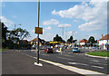
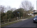
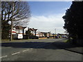
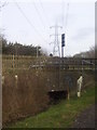


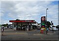
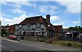
35 photos from this area
Area Information
Key information about the KT19 9HH including its size, population, and administrative classification.
- Area Type
- Postcode
- Area Size
- 1.4 hectares
- Population
- 2527
- Population Density
- 1374 people/km²
House Prices in KT19 9HH
27
Properties
£331,260
Average Sold Price
£79,000
Lowest Price
£555,000
Highest Price
Showing 27 properties
| Address | Type | Beds | Baths | Last Sale Price | Last Sale Date | |
|---|---|---|---|---|---|---|
| 532 Chessington Road, West Ewell, KT19 9HH | Detached | 3 | 1 | £450,000 | Feb 2021 | |
| 510 Chessington Road, West Ewell, KT19 9HH | Bungalow | 3 | - | £555,000 | Jan 2021 | |
| 512 Chessington Road, West Ewell, KT19 9HH | Semi-detached | 3 | 1 | £450,000 | Jul 2019 | |
| 550 Chessington Road, West Ewell, KT19 9HH | Semi-detached | 3 | 1 | £440,000 | Jul 2018 | |
| 528 Chessington Road, West Ewell, KT19 9HH | Semi-detached | 3 | 1 | £455,000 | Jul 2017 | |
| 556 Chessington Road, West Ewell, KT19 9HH | Semi-detached | 4 | 2 | £314,950 | Nov 2013 | |
| 558 Chessington Road, West Ewell, KT19 9HH | house | 4 | - | £418,000 | Oct 2013 | |
| 538 Chessington Road, West Ewell, KT19 9HH | Semi-detached | 3 | 1 | £305,000 | Apr 2013 | |
| 518 Chessington Road, West Ewell, KT19 9HH | Bungalow | 3 | - | £290,000 | Dec 2010 | |
| 548 Chessington Road, West Ewell, KT19 9HH | Terraced | - | - | £299,950 | Nov 2007 |
Page 1 of 3
Energy Efficiency in KT19 9HH
Amenities
Schools
| Rank | School | Type | Entry gender | Ages |
|---|
Explore more schools in this area
Go to Schools tabDemographics
Household Size
Family (3-5 people)
most common
Accommodation Type
Houses
most common
Tenure
85
majority
Ethnic Group
White
most common
Religion
N/A
most common
Household Composition
N/A
most common
Age
47
median
Adults (30-64 years)
most common
Household Deprivation
N/A
with no deprivation
NS-SEC
43
in Lower managerial occupations
Explore more demographic insights in this area
Go to Demographics tabPlanning
Planning Constraints
- Flood RiskPremium
- Ramsar Wetland SitesPremium
- Area of Outstanding Natural BeautyPremium
- Protected Nature ReservePremium
- Protected WoodlandPremium