Area Overview for KT19 9DX
Photos of KT19 9DX
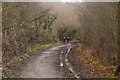
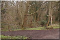
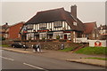
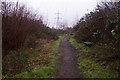
35 photos from this area
Area Information
Key information about the KT19 9DX including its size, population, and administrative classification.
- Area Type
- Postcode
- Area Size
- 7730 m²
- Population
- 2398
- Population Density
- 6832 people/km²
House Prices in KT19 9DX
26
Properties
£230,006
Average Sold Price
£93,500
Lowest Price
£420,000
Highest Price
Showing 26 properties
| Address | Type | Beds | Baths | Last Sale Price | Last Sale Date | |
|---|---|---|---|---|---|---|
| 124 Jasmin Road, West Ewell, KT19 9DX | Retail | 2 | 1 | £410,000 | Nov 2022 | |
| 157 Jasmin Road, West Ewell, KT19 9DX | Detached | 3 | 1 | £394,000 | Apr 2018 | |
| 163 Jasmin Road, West Ewell, KT19 9DX | Detached | 3 | 1 | £420,000 | Dec 2017 | |
| 175 Jasmin Road, West Ewell, KT19 9DX | Semi-detached | 3 | - | £279,950 | Aug 2013 | |
| 171 Jasmin Road, West Ewell, KT19 9DX | Semi-detached | - | - | £125,000 | Feb 2012 | |
| 122 Jasmin Road, West Ewell, KT19 9DX | house | - | - | £126,500 | Jun 2009 | |
| 112 Jasmin Road, West Ewell, KT19 9DX | Terraced | - | - | £119,350 | Aug 2007 | |
| 106 Jasmin Road, West Ewell, KT19 9DX | house | - | - | £93,500 | Jun 2004 | |
| 114 Jasmin Road, West Ewell, KT19 9DX | house | - | - | £101,750 | Feb 2004 | |
| 177 Jasmin Road, West Ewell, KT19 9DX | Semi-detached | 3 | 1 | - | - |
Page 1 of 3
Energy Efficiency in KT19 9DX
Amenities
Schools
| Rank | School | Type | Entry gender | Ages |
|---|
Explore more schools in this area
Go to Schools tabDemographics
Household Size
Family (3-5 people)
most common
Accommodation Type
Houses
most common
Tenure
71
majority
Ethnic Group
White
most common
Religion
N/A
most common
Household Composition
N/A
most common
Age
47
median
Adults (30-64 years)
most common
Household Deprivation
N/A
with no deprivation
NS-SEC
32
in Lower managerial occupations
Explore more demographic insights in this area
Go to Demographics tabPlanning
Planning Constraints
- Flood RiskPremium
- Ramsar Wetland SitesPremium
- Area of Outstanding Natural BeautyPremium
- Protected Nature ReservePremium
- Protected WoodlandPremium