Area Overview for KT19 7NH
Photos of KT19 7NH
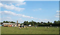
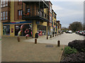
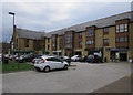

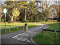
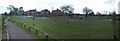
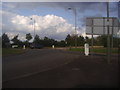
23 photos from this area
Area Information
Key information about the KT19 7NH including its size, population, and administrative classification.
- Area Type
- Postcode
- Area Size
- 1.7 hectares
- Population
- 2527
- Population Density
- 1374 people/km²
House Prices in KT19 7NH
32
Properties
£380,950
Average Sold Price
£200,000
Lowest Price
£545,000
Highest Price
Showing 32 properties
| Address | Type | Beds | Baths | Last Sale Price | Last Sale Date | |
|---|---|---|---|---|---|---|
| 28, Harvey Court, Sandy Mead, Epsom, KT19 7NH | Flat | - | - | £429,000 | Dec 2022 | |
| 8, Harvey Court, Sandy Mead, Epsom, KT19 7NH | Flat | 2 | 2 | £437,500 | Jun 2022 | |
| 13, Harvey Court, Sandy Mead, Epsom, KT19 7NH | Flat | 2 | 1 | £445,000 | Jun 2022 | |
| 25, Harvey Court, Sandy Mead, Epsom, KT19 7NH | Flat | - | - | £428,250 | Jul 2021 | |
| 27, Harvey Court, Sandy Mead, Epsom, KT19 7NH | Flat | - | - | £490,750 | Dec 2019 | |
| 3, Harvey Court, Sandy Mead, Epsom, KT19 7NH | Flat | 2 | 2 | £545,000 | Aug 2019 | |
| 14, Harvey Court, Sandy Mead, Epsom, KT19 7NH | Flat | 2 | 2 | £346,000 | Aug 2019 | |
| 24, Harvey Court, Sandy Mead, Epsom, KT19 7NH | Flat | 2 | 2 | £385,000 | Mar 2019 | |
| 19, Harvey Court, Sandy Mead, Epsom, KT19 7NH | Flat | - | - | £317,500 | Mar 2019 | |
| 21, Harvey Court, Sandy Mead, Epsom, KT19 7NH | Terraced | 3 | 2 | £535,000 | Feb 2019 |
Page 1 of 4
Energy Efficiency in KT19 7NH
Amenities
Schools
| Rank | School | Type | Entry gender | Ages |
|---|
Explore more schools in this area
Go to Schools tabDemographics
Household Size
Family (3-5 people)
most common
Accommodation Type
Houses
most common
Tenure
85
majority
Ethnic Group
White
most common
Religion
N/A
most common
Household Composition
N/A
most common
Age
47
median
Adults (30-64 years)
most common
Household Deprivation
N/A
with no deprivation
NS-SEC
43
in Lower managerial occupations
Explore more demographic insights in this area
Go to Demographics tabPlanning
Planning Constraints
- Flood RiskPremium
- Ramsar Wetland SitesPremium
- Area of Outstanding Natural BeautyPremium
- Protected Nature ReservePremium
- Protected WoodlandPremium