Area Overview for KT19 0UY
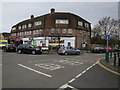
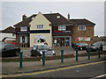
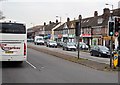
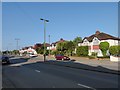
Photos of KT19 0UY


Area Information
KT19 0UY is a compact residential postcode in England, spanning just 2 hectares and home to 1,818 people. Its high population density of 92,231 people per square kilometre reflects a tightly knit community. This area is characterised by a focus on single-family homes, with 91% of properties owned by residents rather than rented. Daily life here is shaped by proximity to essential services and transport links. The postcode’s small size means residents are likely to know their neighbours, with a median age of 47 suggesting a mature demographic. While the area lacks large-scale amenities, its strategic location offers access to nearby towns and natural features. The presence of a primary school with a ‘good’ Ofsted rating adds to its appeal for families. However, the high flood risk score of 58.33 indicates a need for caution, particularly for those considering long-term property investment. For buyers seeking a quiet, established neighbourhood with practical connectivity, KT19 0UY presents a mix of opportunities and considerations.
- Area Type
- Postcode
- Area Size
- 2.0 hectares
- Population
- 1818
- Population Density
- 3699 people/km²
KT19 0UY is predominantly an owner-occupied area, with 91% of properties owned by residents. The accommodation type is exclusively houses, which is unusual for a postcode of this small size but suggests a focus on single-family homes. This makes the area distinct from more densely populated regions with higher rental markets. The limited size of KT19 0UY means the housing stock is finite, and buyers should consider the immediate surrounding areas for additional options. The high home ownership rate indicates a community of long-term residents, which may influence property values and demand. For those seeking a home in this postcode, the availability of houses rather than flats or apartments is a key consideration. Buyers should also factor in the area’s flood risk when evaluating property suitability, as this could impact insurance costs and long-term viability.
House Prices in KT19 0UY
No properties found in this postcode.
Energy Efficiency in KT19 0UY
KT19 0UY offers a range of nearby amenities within practical reach, including retail stores such as Tesco Ruxley, Aldi West, and The Southern Co-operative. These shops provide everyday essentials, supporting a convenient lifestyle for residents. The area’s proximity to rail stations like Ewell West and Tolworth, along with ferry landings at Ditton Island and Kingston, ensures easy access to broader transport networks. Metro and tram stops, including Morden Road Tram Stop, further connect the area to surrounding regions. While the postcode itself is small, the availability of multiple retail and transport options suggests a functional, community-oriented environment. The mix of retail, rail, and ferry services indicates that daily life in KT19 0UY is characterised by accessibility, though the lack of local parks or leisure facilities means residents may need to travel for recreational activities.
Amenities
Schools
The nearest school to KT19 0UY is West Ewell Primary School and Nursery, which serves the area with a ‘good’ Ofsted rating. This primary school is the sole educational institution listed in the data, indicating a focus on early and primary education for local families. The absence of secondary schools or further education institutions within the postcode means residents may need to travel to nearby towns for higher-level schooling. However, the ‘good’ rating for the primary school suggests a reliable foundation for children’s education. For families prioritising strong local schools, this is a positive feature, though additional research into secondary school options in adjacent areas would be necessary. The single school listed reflects the small scale of KT19 0UY, where educational infrastructure is limited to primary level.
| Rank | School | Type | Entry gender | Ages |
|---|
Explore more schools in this area
Go to Schools tabDemographics
The population of KT19 0UY is predominantly adults aged 30–64, with a median age of 47. This suggests a community of working professionals and families, rather than a younger or older demographic. Home ownership is exceptionally high at 91%, indicating a stable, long-term resident base. The accommodation type is primarily houses, which aligns with the area’s residential character. The predominant ethnic group is White, reflecting a homogenous population. While no specific data on deprivation is provided, the high home ownership rate and mature age profile imply a relatively affluent community. However, the lack of diversity in ethnicity and the absence of specific data on income levels mean that broader socioeconomic factors remain unclear. For prospective buyers, the demographic profile suggests a neighbourhood focused on stability and family living, though further local insights may be needed to assess broader quality-of-life factors.
Household Size
Accommodation Type
Tenure
Ethnic Group
Religion
Household Composition
Age
Household Deprivation
NS-SEC
Explore more demographic insights in this area
Go to Demographics tabPlanning
Planning Constraints
- Flood RiskPremium
- Ramsar Wetland SitesPremium
- Area of Outstanding Natural BeautyPremium
- Protected Nature ReservePremium
- Protected WoodlandPremium