Area Overview for KT18 7ET
Photos of KT18 7ET
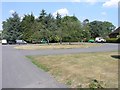
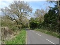
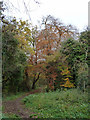
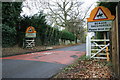
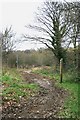
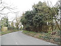
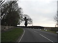
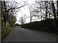


13 photos from this area
Area Information
Key information about the KT18 7ET including its size, population, and administrative classification.
- Area Type
- Postcode
- Area Size
- 12.0 hectares
- Population
- 1516
- Population Density
- 505 people/km²
House Prices in KT18 7ET
18
Properties
£2,373,846
Average Sold Price
£415,000
Lowest Price
£5,600,000
Highest Price
Showing 18 properties
| Address | Type | Beds | Baths | Last Sale Price | Last Sale Date | |
|---|---|---|---|---|---|---|
| Sunnybank, The Ridge, Epsom, KT18 7ET | house | - | - | £3,500,000 | Jun 2023 | |
| Ridgegate View, The Ridge, Epsom, KT18 7ET | Retail | 6 | 6 | £2,680,000 | Apr 2022 | |
| Four Winds, The Ridge, Epsom, KT18 7ET | house | 5 | - | £2,800,000 | Apr 2021 | |
| The Georgian House, The Ridge, Epsom, KT18 7ET | house | - | - | £2,500,000 | Feb 2018 | |
| Pine Ridge, The Ridge, Epsom, KT18 7ET | Detached | 6 | 6 | £2,450,000 | Oct 2017 | |
| Springfields, The Ridge, Epsom, KT18 7ET | house | - | - | £2,100,000 | Dec 2014 | |
| St Magnus, The Ridge, Epsom, KT18 7ET | Detached | 7 | - | £3,050,000 | Jun 2013 | |
| Woodpeckers, The Ridge, Epsom, KT18 7ET | Detached | 6 | 4 | £1,675,000 | Jan 2012 | |
| Parkside, The Ridge, Epsom, KT18 7ET | house | 6 | - | £5,600,000 | May 2010 | |
| Clare House, The Ridge, Epsom, KT18 7ET | house | - | - | £1,825,000 | Jun 2007 |
Page 1 of 2
Energy Efficiency in KT18 7ET
Amenities
Schools
| Rank | School | Type | Entry gender | Ages |
|---|
Explore more schools in this area
Go to Schools tabDemographics
Household Size
Family (3-5 people)
most common
Accommodation Type
Houses
most common
Tenure
90
majority
Ethnic Group
White
most common
Religion
N/A
most common
Household Composition
N/A
most common
Age
47
median
Adults (30-64 years)
most common
Household Deprivation
N/A
with no deprivation
NS-SEC
48
in Lower managerial occupations
Explore more demographic insights in this area
Go to Demographics tabPlanning
Planning Constraints
- Flood RiskPremium
- Ramsar Wetland SitesPremium
- Area of Outstanding Natural BeautyPremium
- Protected Nature ReservePremium
- Protected WoodlandPremium