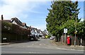
Area Overview for KT18 7EG
Photos of KT18 7EG


Area Information
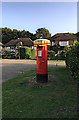
KT18 7EG is a compact residential postcode in England, covering just 1.9 hectares and home to 1,795 residents. Its high population density of 95,767 people per square kilometre reflects a tightly knit community, where daily life is shaped by proximity to local amenities and transport links. The area is characterised by a mix of primary schools, retail outlets, and railway stations, making it practical for families and commuters. While the small size means limited space for expansion, it also fosters a sense of familiarity among residents. The area’s appeal lies in its balance of accessibility and compactness, with nearby schools, shops, and transport hubs within walking or short driving distance. For those prioritising convenience over sprawling landscapes, KT18 7EG offers a focused environment where community interactions are frequent and local services are readily available.
- Area Type
- Postcode
- Area Size
- 1.9 hectares
- Population
- 1795
- Population Density
- 2630 people/km²
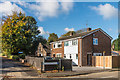
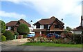
KT18 7EG is primarily an owner-occupied area, with 72% of homes owned by residents rather than rented. The accommodation type is predominantly houses, which is unusual for a small postcode but may reflect a mix of older properties and newer developments. This suggests a market where property values are likely to be stable, as demand from long-term residents and families seeking homes with space is consistent. The limited size of the area means the housing stock is finite, so buyers should consider nearby suburbs for additional options. For those prioritising home ownership, KT18 7EG offers a compact, established environment, though the lack of rental properties may limit flexibility for those needing temporary housing.
House Prices in KT18 7EG
Showing 18 properties
Energy Efficiency in KT18 7EG
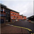
Living in KT18 7EG offers access to a range of amenities within practical reach. Retail options include M&S Woodcote BP, M&S Epsom, and Co-op Epsom, providing everyday shopping needs. For transport, Epsom Railway Station and nearby ferry landings like Ditton Island Ferry Landing and Kingston Town End Pier offer connections to both land and water routes. While the area lacks large parks or leisure facilities, the presence of ferry access suggests proximity to riverside activities. The mix of retail, rail, and ferry options supports a lifestyle that balances convenience with the ability to explore nearby towns. The compact nature of the area means amenities are concentrated, requiring minimal travel for essentials, though residents may need to venture further for more extensive recreational opportunities.
Amenities
Schools
KT18 7EG is served by several primary schools, including St Martin’s CofE (Aided) Junior School, St Martin’s CofE Aided Infant School in Epsom, and St Joseph’s Catholic Primary School, which holds an outstanding Ofsted rating. Other options include Rosebery School and the independent Convent of the Sacred Hearts School. The mix of state and independent schools provides families with choices, from free education to fee-paying institutions. The presence of an outstanding-rated school indicates high standards in at least one local institution, which can be a significant draw for families. However, the density of primary schools suggests a focus on younger children, with no mention of secondary schools in the data. This may require families to look beyond the immediate area for comprehensive education.
| Rank | School | Type | Entry gender | Ages |
|---|
Explore more schools in this area
Go to Schools tabDemographics
The median age in KT18 7EG is 47, with the majority of residents aged between 30 and 64 years. This suggests a stable, mature population, likely with established careers and family commitments. Home ownership is high, at 72%, indicating a strong presence of long-term residents. The accommodation type is predominantly houses, which aligns with the area’s residential character. The predominant ethnic group is White, reflecting a demographic profile typical of many suburban or semi-rural postcode areas. While no specific data on deprivation is provided, the high home ownership rate and proximity to amenities suggest a relatively stable quality of life. However, the average age and ownership figures also imply limited turnover, which could affect the diversity of the community.
Household Size
Accommodation Type
Tenure
Ethnic Group
Religion
Household Composition
Age
Household Deprivation
NS-SEC
Explore more demographic insights in this area
Go to Demographics tabPlanning
Planning Constraints
- Flood RiskPremium
- Ramsar Wetland SitesPremium
- Area of Outstanding Natural BeautyPremium
- Protected Nature ReservePremium
- Protected WoodlandPremium