Area Overview for KT18 5XA
Photos of KT18 5XA
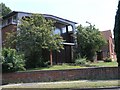
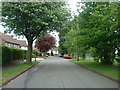
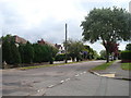
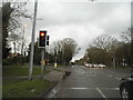


24 photos from this area
Area Information
Key information about the KT18 5XA including its size, population, and administrative classification.
- Area Type
- Postcode
- Area Size
- 2.4 hectares
- Population
- 1654
- Population Density
- 2379 people/km²
House Prices in KT18 5XA
15
Properties
£709,000
Average Sold Price
£250,000
Lowest Price
£1,500,000
Highest Price
Showing 15 properties
| Address | Type | Beds | Baths | Last Sale Price | Last Sale Date | |
|---|---|---|---|---|---|---|
| 476 Reigate Road, Epsom Downs, KT18 5XA | house | - | - | £725,000 | Oct 2024 | |
| 472 Reigate Road, Epsom Downs, KT18 5XA | Retirement | - | - | £1,500,000 | Jul 2018 | |
| Whitethorns, 452 Reigate Road, Epsom Downs, KT18 5XA | Detached | - | - | £670,000 | Feb 2006 | |
| Wychwood, 454 Reigate Road, Epsom Downs, KT18 5XA | Detached | - | - | £400,000 | Oct 2001 | |
| Rosebery Manor, 458 Reigate Road, Epsom Downs, KT18 5XA | Retirement | - | - | £250,000 | May 1998 | |
| Chealands, 464 Reigate Road, Epsom Downs, KT18 5XA | Detached | 4 | 2 | - | - | |
| Former The Pines, 450 Reigate Road, Epsom Downs, KT18 5XA | Detached | - | - | - | - | |
| Former The Wickets, 456 Reigate Road, Epsom Downs, KT18 5XA | Detached | - | - | - | - | |
| Oak Angles, 458 Reigate Road, Epsom Downs, KT18 5XA | Detached | - | - | - | - | |
| Studland, 462 Reigate Road, Epsom Downs, KT18 5XA | house | - | - | - | - |
Page 1 of 2
Energy Efficiency in KT18 5XA
Amenities
Schools
| Rank | School | Type | Entry gender | Ages |
|---|
Explore more schools in this area
Go to Schools tabDemographics
Household Size
Family (3-5 people)
most common
Accommodation Type
Houses
most common
Tenure
92
majority
Ethnic Group
White
most common
Religion
N/A
most common
Household Composition
N/A
most common
Age
47
median
Adults (30-64 years)
most common
Household Deprivation
N/A
with no deprivation
NS-SEC
50
in Lower managerial occupations
Explore more demographic insights in this area
Go to Demographics tabPlanning
Planning Constraints
- Flood RiskPremium
- Ramsar Wetland SitesPremium
- Area of Outstanding Natural BeautyPremium
- Protected Nature ReservePremium
- Protected WoodlandPremium