Area Overview for KT18 5QT
Photos of KT18 5QT

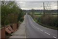

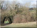

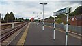

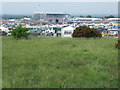
36 photos from this area
Area Information
Key information about the KT18 5QT including its size, population, and administrative classification.
- Area Type
- Postcode
- Area Size
- 1.7 hectares
- Population
- 1551
- Population Density
- 3186 people/km²
House Prices in KT18 5QT
31
Properties
£423,575
Average Sold Price
£138,000
Lowest Price
£665,000
Highest Price
Showing 31 properties
| Address | Type | Beds | Baths | Last Sale Price | Last Sale Date | |
|---|---|---|---|---|---|---|
| 73 Tattenham Grove, Epsom Downs, KT18 5QT | Semi-detached | 4 | 2 | £665,000 | Mar 2024 | |
| 39 Tattenham Grove, Epsom Downs, KT18 5QT | house | - | - | £660,000 | Apr 2021 | |
| 61 Tattenham Grove, Epsom Downs, KT18 5QT | house | - | - | £627,500 | Feb 2021 | |
| 75 Tattenham Grove, Epsom Downs, KT18 5QT | Semi-detached | 4 | - | £527,500 | Oct 2019 | |
| 97 Tattenham Grove, Epsom Downs, KT18 5QT | Bungalow | 3 | 1 | £510,000 | Sep 2019 | |
| 37 Tattenham Grove, Epsom Downs, KT18 5QT | Semi-detached | 3 | 1 | £601,000 | May 2018 | |
| 65 Tattenham Grove, Epsom Downs, KT18 5QT | Detached | 3 | - | £605,000 | Oct 2016 | |
| 57 Tattenham Grove, Epsom Downs, KT18 5QT | Semi-detached | 4 | 3 | £500,000 | Nov 2014 | |
| 43 Tattenham Grove, Epsom Downs, KT18 5QT | house | 3 | - | £450,000 | Sep 2010 | |
| 55 Tattenham Grove, Epsom Downs, KT18 5QT | Semi-detached | - | - | £315,000 | Jun 2009 |
Page 1 of 4
Energy Efficiency in KT18 5QT
Amenities
Schools
| Rank | School | Type | Entry gender | Ages |
|---|
Explore more schools in this area
Go to Schools tabDemographics
Household Size
Family (3-5 people)
most common
Accommodation Type
Houses
most common
Tenure
82
majority
Ethnic Group
White
most common
Religion
N/A
most common
Household Composition
N/A
most common
Age
47
median
Adults (30-64 years)
most common
Household Deprivation
N/A
with no deprivation
NS-SEC
47
in Lower managerial occupations
Explore more demographic insights in this area
Go to Demographics tabPlanning
Planning Constraints
- Flood RiskPremium
- Ramsar Wetland SitesPremium
- Area of Outstanding Natural BeautyPremium
- Protected Nature ReservePremium
- Protected WoodlandPremium