Area Overview for KT18 5PH
Photos of KT18 5PH
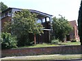
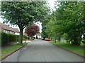
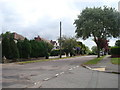
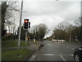
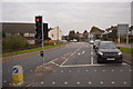

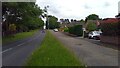
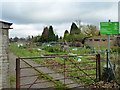
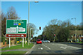
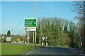

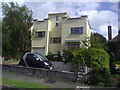
24 photos from this area
Area Information
Key information about the KT18 5PH including its size, population, and administrative classification.
- Area Type
- Postcode
- Area Size
- 1.5 hectares
- Population
- 1713
- Population Density
- 3921 people/km²
House Prices in KT18 5PH
27
Properties
£372,120
Average Sold Price
£137,000
Lowest Price
£693,325
Highest Price
Showing 27 properties
| Address | Type | Beds | Baths | Last Sale Price | Last Sale Date | |
|---|---|---|---|---|---|---|
| 14 Shawley Crescent, Epsom Downs, KT18 5PH | Maisonette | 3 | 1 | £422,500 | Aug 2025 | |
| 50 Shawley Crescent, Epsom Downs, KT18 5PH | Semi-detached | 4 | 2 | £693,325 | Jun 2025 | |
| 24 Shawley Crescent, Epsom Downs, KT18 5PH | Terraced | 4 | 2 | £575,000 | Jan 2023 | |
| 26 Shawley Crescent, Epsom Downs, KT18 5PH | Semi-detached | 3 | 1 | £568,000 | Jun 2022 | |
| 32 Shawley Crescent, Epsom Downs, KT18 5PH | Maisonette | 2 | - | £345,000 | Feb 2021 | |
| 46 Shawley Crescent, Epsom Downs, KT18 5PH | Maisonette | 2 | 1 | £270,000 | Oct 2020 | |
| 22 Shawley Crescent, Epsom Downs, KT18 5PH | Terraced | 3 | 1 | £465,000 | Mar 2020 | |
| 52 Shawley Crescent, Epsom Downs, KT18 5PH | Bungalow | 4 | 2 | £560,000 | Feb 2019 | |
| 2 Shawley Crescent, Epsom Downs, KT18 5PH | Semi-detached | 4 | 2 | £603,500 | Feb 2018 | |
| 42 Shawley Crescent, Epsom Downs, KT18 5PH | Maisonette | 3 | 1 | £300,000 | Nov 2015 |
Page 1 of 3
Energy Efficiency in KT18 5PH
Amenities
Schools
| Rank | School | Type | Entry gender | Ages |
|---|
Explore more schools in this area
Go to Schools tabDemographics
Household Size
Family (3-5 people)
most common
Accommodation Type
Houses
most common
Tenure
83
majority
Ethnic Group
White
most common
Religion
N/A
most common
Household Composition
N/A
most common
Age
47
median
Adults (30-64 years)
most common
Household Deprivation
N/A
with no deprivation
NS-SEC
42
in Lower managerial occupations
Explore more demographic insights in this area
Go to Demographics tabPlanning
Planning Constraints
- Flood RiskPremium
- Ramsar Wetland SitesPremium
- Area of Outstanding Natural BeautyPremium
- Protected Nature ReservePremium
- Protected WoodlandPremium