Area Overview for KT18 5EP
Photos of KT18 5EP
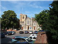
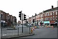
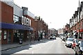
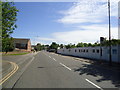
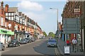
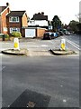
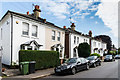
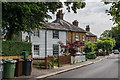
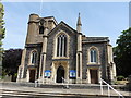
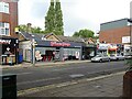
64 photos from this area
Area Information
Key information about the KT18 5EP including its size, population, and administrative classification.
- Area Type
- Postcode
- Area Size
- 5759 m²
- Population
- 1398
- Population Density
- 6044 people/km²
House Prices in KT18 5EP
27
Properties
£646,279
Average Sold Price
£124,000
Lowest Price
£1,250,000
Highest Price
Showing 27 properties
| Address | Type | Beds | Baths | Last Sale Price | Last Sale Date | |
|---|---|---|---|---|---|---|
| 21D Worple Road, Epsom, KT18 5EP | Flat | 2 | 1 | £205,000 | Jul 2024 | |
| 23 Worple Road, Epsom, KT18 5EP | Semi-detached | 1 | 2 | £1,100,000 | Dec 2023 | |
| Copperfield House, 13 Worple Road, Epsom, KT18 5EP | hospital_care_home | - | - | £1,200,000 | Aug 2023 | |
| 19D Worple Road, Epsom, KT18 5EP | Maisonette | 2 | 1 | £305,000 | Jun 2021 | |
| 31 Worple Road, Epsom, KT18 5EP | Semi-detached | 6 | 2 | £1,250,000 | Mar 2020 | |
| 27 Worple Road, Epsom, KT18 5EP | Unknown | - | - | £339,950 | Mar 2016 | |
| 17 Worple Road, Epsom, KT18 5EP | Semi-detached | - | - | £124,000 | Apr 1995 | |
| 33B Worple Road, Epsom, KT18 5EP | Flat | 2 | 1 | - | - | |
| Flat 3, 15 Worple Road, Epsom, KT18 5EP | Flat | 1 | 1 | - | - | |
| 19A Worple Road, Epsom, KT18 5EP | Flat | 2 | 1 | - | - |
Page 1 of 3
Energy Efficiency in KT18 5EP
Amenities
Schools
| Rank | School | Type | Entry gender | Ages |
|---|
Explore more schools in this area
Go to Schools tabDemographics
Household Size
One person
most common
Accommodation Type
Flats
most common
Tenure
43
majority
Ethnic Group
White
most common
Religion
N/A
most common
Household Composition
N/A
most common
Age
47
median
Adults (30-64 years)
most common
Household Deprivation
N/A
with no deprivation
NS-SEC
37
in Lower managerial occupations
Explore more demographic insights in this area
Go to Demographics tabPlanning
Planning Constraints
- Flood RiskPremium
- Ramsar Wetland SitesPremium
- Area of Outstanding Natural BeautyPremium
- Protected Nature ReservePremium
- Protected WoodlandPremium