Area Overview for KT18 5BE
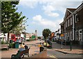
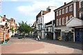
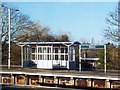
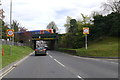
Photos of KT18 5BE


Area Information
KT18 5BE is a small, densely populated residential postcode area in England, covering 5,436 square metres and home to 1,398 residents. Its compact size means the community is tightly knit, with a high population density of 257,154 people per square kilometre. This area is characterised by a mix of practical living and limited space, where daily life revolves around proximity to local amenities and transport links. The postcode sits within a broader network of nearby towns and villages, offering access to a range of services without the need for long commutes. Residents here are predominantly adults aged 30–64, with a median age of 47, suggesting a mature, stable community. While the area’s small footprint may feel cramped, its strategic location near rail and ferry services ensures connectivity to larger urban centres. For those considering living in KT18 5BE, the challenge lies in balancing the density with the convenience of nearby infrastructure, which includes retail, transport, and leisure options within walking distance.
- Area Type
- Postcode
- Area Size
- 5436 m²
- Population
- 1398
- Population Density
- 6044 people/km²
KT18 5BE’s property market is defined by its high density and limited land availability. With 43% of homes owned by residents, the area leans more towards a rental market than owner-occupation. The predominant accommodation type is flats, which suits the compact nature of the postcode but may limit options for those seeking larger properties. This dynamic creates a competitive environment for buyers, as the small area’s housing stock is finite. For those considering purchase, the focus would likely be on securing a flat within the immediate vicinity, given the lack of expansive housing developments. The proximity to transport links, including rail and ferry services, may enhance the appeal of rental properties, as they cater to commuters. However, the high population density and small footprint mean that property availability is constrained, requiring buyers to act decisively.
House Prices in KT18 5BE
No properties found in this postcode.
Energy Efficiency in KT18 5BE
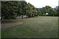
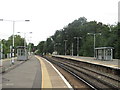
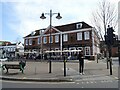
Living in KT18 5BE offers access to a range of amenities within walking distance. Retail options include M&S Epsom, M&S Woodcote BP, and Co-op Epsom, providing essential shopping and dining choices. The area’s transport links also serve as gateways to broader leisure opportunities, such as the nearby ferry services to Kingston’s piers and the rail connections to Epsom Downs. While the data does not detail parks or recreational spaces, the proximity to rail and ferry services suggests access to green spaces in surrounding areas. The mix of retail, transport, and commuter-friendly infrastructure creates a practical lifestyle, where daily needs are met without long journeys. However, the absence of specific details on parks or leisure facilities means the full extent of recreational options remains unexplored.
Amenities
Schools
The nearest school to KT18 5BE is the Epsom School of Art and Design, which is categorised as an "other" institution. No specific Ofsted rating is provided, so its educational quality remains unverified. The absence of primary or secondary schools in the data suggests that families may need to look beyond the immediate area for comprehensive schooling options. This could be a consideration for prospective buyers, as the mix of school types is limited. While the Epsom School of Art and Design may offer specialised courses, it is unclear whether it caters to younger students or those pursuing vocational training. For families requiring a full range of educational facilities, additional research into nearby schools would be necessary, as the data does not cover this aspect.
| Rank | School | Type | Entry gender | Ages |
|---|
Explore more schools in this area
Go to Schools tabDemographics
The population of KT18 5BE is skewed towards adults aged 30–64, with a median age of 47. This suggests a community of established professionals and families, rather than a younger or retired demographic. Home ownership here is relatively low at 43%, indicating that a significant portion of the housing stock is rented. The accommodation type is predominantly flats, which aligns with the area’s high density and limited land availability. The predominant ethnic group is White, though no specific data on diversity or deprivation is provided. The age profile and home ownership figures suggest a community that may prioritise rental flexibility over long-term property investment. With a population of 1,398, the area’s small size means interactions are likely frequent, fostering a sense of familiarity among residents. However, the lack of detailed diversity data means the full range of community experiences remains unexplored.
Household Size
Accommodation Type
Tenure
Ethnic Group
Religion
Household Composition
Age
Household Deprivation
NS-SEC
Explore more demographic insights in this area
Go to Demographics tabPlanning
Planning Constraints
- Flood RiskPremium
- Ramsar Wetland SitesPremium
- Area of Outstanding Natural BeautyPremium
- Protected Nature ReservePremium
- Protected WoodlandPremium