Area Overview for KT17 4RH
Photos of KT17 4RH
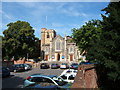
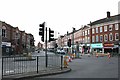
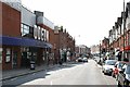
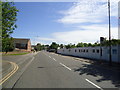
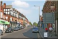
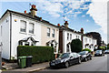
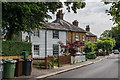
64 photos from this area
Area Information
Key information about the KT17 4RH including its size, population, and administrative classification.
- Area Type
- Postcode
- Area Size
- 1145 m²
- Population
- 1398
- Population Density
- 6044 people/km²
House Prices in KT17 4RH
8
Properties
£227,300
Average Sold Price
£67,500
Lowest Price
£595,000
Highest Price
Showing 8 properties
| Address | Type | Beds | Baths | Last Sale Price | Last Sale Date | |
|---|---|---|---|---|---|---|
| 4A, The Quadrant, Upper High Street, Epsom, KT17 4RH | Flat | - | - | £595,000 | Nov 2020 | |
| 5A, The Quadrant, Upper High Street, Epsom, KT17 4RH | Flat | - | - | £200,000 | Apr 2008 | |
| 3A, The Quadrant, Upper High Street, Epsom, KT17 4RH | Maisonette | 3 | 1 | £196,000 | Nov 2004 | |
| 6A, The Quadrant, Upper High Street, Epsom, KT17 4RH | Maisonette | - | - | £78,000 | Sep 1999 | |
| 7A, The Quadrant, Upper High Street, Epsom, KT17 4RH | Maisonette | - | - | £67,500 | Apr 1999 | |
| 2A, Second Floor Right, The Quadrant, Upper High Street, Epsom, KT17 4RH | Office | - | - | - | - | |
| 2A, Second Floor Left, The Quadrant, Upper High Street, Epsom, KT17 4RH | Office | - | - | - | - | |
| Be A Can, 2A, First Floor Office, The Quadrant, Upper High Street, Epsom, KT17 4RH | Office | - | - | - | - |
Energy Efficiency in KT17 4RH
Amenities
Schools
| Rank | School | Type | Entry gender | Ages |
|---|
Explore more schools in this area
Go to Schools tabDemographics
Household Size
One person
most common
Accommodation Type
Flats
most common
Tenure
43
majority
Ethnic Group
White
most common
Religion
N/A
most common
Household Composition
N/A
most common
Age
47
median
Adults (30-64 years)
most common
Household Deprivation
N/A
with no deprivation
NS-SEC
37
in Lower managerial occupations
Explore more demographic insights in this area
Go to Demographics tabPlanning
Planning Constraints
- Flood RiskPremium
- Ramsar Wetland SitesPremium
- Area of Outstanding Natural BeautyPremium
- Protected Nature ReservePremium
- Protected WoodlandPremium