Area Overview for KT17 4LQ
Photos of KT17 4LQ
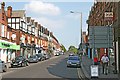
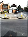
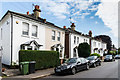
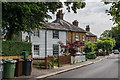
64 photos from this area
Area Information
Key information about the KT17 4LQ including its size, population, and administrative classification.
- Area Type
- Postcode
- Area Size
- 3.0 hectares
- Population
- 1449
- Population Density
- 1065 people/km²
House Prices in KT17 4LQ
13
Properties
£1,058,545
Average Sold Price
£461,500
Lowest Price
£1,900,000
Highest Price
Showing 13 properties
| Address | Type | Beds | Baths | Last Sale Price | Last Sale Date | |
|---|---|---|---|---|---|---|
| 3 Lynwood Avenue, Epsom, KT17 4LQ | Detached | 4 | 1 | £1,207,500 | Jun 2024 | |
| 5 Lynwood Avenue, Epsom, KT17 4LQ | house | - | - | £1,900,000 | Jan 2022 | |
| 9 Lynwood Avenue, Epsom, KT17 4LQ | Detached | 5 | 3 | £1,525,000 | Nov 2020 | |
| Zebrato, Lynwood Avenue, Epsom, KT17 4LQ | Detached | 4 | 2 | £995,000 | Sep 2020 | |
| 4A Lynwood Avenue, Epsom, KT17 4LQ | Detached | 5 | 2 | £1,000,000 | Aug 2015 | |
| Leysin, Lynwood Avenue, Epsom, KT17 4LQ | Bungalow | 3 | 2 | £815,000 | Jul 2015 | |
| Lynwood, 4C Lynwood Avenue, Epsom, KT17 4LQ | Bungalow | 5 | 4 | £1,225,000 | Aug 2013 | |
| 7 Lynwood Avenue, Epsom, KT17 4LQ | Detached | - | - | £955,000 | May 2010 | |
| 2 Lynwood Avenue, Epsom, KT17 4LQ | Detached | - | - | £810,000 | Mar 2007 | |
| 6 Lynwood Avenue, Epsom, KT17 4LQ | Detached | 5 | 2 | £750,000 | Oct 2004 |
Page 1 of 2
Energy Efficiency in KT17 4LQ
Amenities
Schools
| Rank | School | Type | Entry gender | Ages |
|---|
Explore more schools in this area
Go to Schools tabDemographics
Household Size
Family (3-5 people)
most common
Accommodation Type
Houses
most common
Tenure
89
majority
Ethnic Group
White
most common
Religion
N/A
most common
Household Composition
N/A
most common
Age
47
median
Adults (30-64 years)
most common
Household Deprivation
N/A
with no deprivation
NS-SEC
56
in Lower managerial occupations
Explore more demographic insights in this area
Go to Demographics tabPlanning
Planning Constraints
- Flood RiskPremium
- Ramsar Wetland SitesPremium
- Area of Outstanding Natural BeautyPremium
- Protected Nature ReservePremium
- Protected WoodlandPremium