Area Overview for KT17 4LP
Photos of KT17 4LP
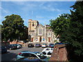
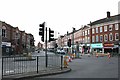
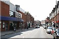
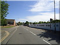
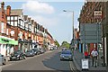
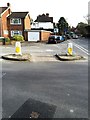
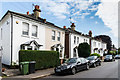
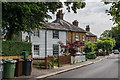
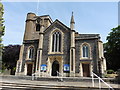
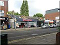
64 photos from this area
Area Information
Key information about the KT17 4LP including its size, population, and administrative classification.
- Area Type
- Postcode
- Area Size
- 1.3 hectares
- Population
- 1465
- Population Density
- 3860 people/km²
House Prices in KT17 4LP
29
Properties
£733,140
Average Sold Price
£175,000
Lowest Price
£1,625,000
Highest Price
Showing 29 properties
| Address | Type | Beds | Baths | Last Sale Price | Last Sale Date | |
|---|---|---|---|---|---|---|
| 41 Burgh Heath Road, Epsom, KT17 4LP | Semi-detached | 2 | 1 | £490,000 | Feb 2025 | |
| 15 Burgh Heath Road, Epsom, KT17 4LP | Semi-detached | 4 | 3 | £1,022,040 | Aug 2023 | |
| 27 Burgh Heath Road, Epsom, KT17 4LP | Detached | 3 | 2 | £1,180,000 | Oct 2021 | |
| 37 Burgh Heath Road, Epsom, KT17 4LP | Detached | 5 | 3 | £1,625,000 | Mar 2020 | |
| 13 Burgh Heath Road, Epsom, KT17 4LP | house | - | - | £1,035,000 | Apr 2018 | |
| 21 Burgh Heath Road, Epsom, KT17 4LP | Detached | 5 | 2 | £770,000 | Jul 2012 | |
| 17 Burgh Heath Road, Epsom, KT17 4LP | Semi-detached | - | - | £575,000 | Jun 2005 | |
| 19 Burgh Heath Road, Epsom, KT17 4LP | Detached | 5 | 3 | £482,500 | Aug 2003 | |
| 31A Burgh Heath Road, Epsom, KT17 4LP | Detached | - | - | £400,000 | Jan 2003 | |
| 31 Burgh Heath Road, Epsom, KT17 4LP | Detached | - | - | £310,000 | Aug 1997 |
Page 1 of 3
Energy Efficiency in KT17 4LP
Amenities
Schools
| Rank | School | Type | Entry gender | Ages |
|---|
Explore more schools in this area
Go to Schools tabDemographics
Household Size
One person
most common
Accommodation Type
Houses
most common
Tenure
73
majority
Ethnic Group
White
most common
Religion
N/A
most common
Household Composition
N/A
most common
Age
47
median
Adults (30-64 years)
most common
Household Deprivation
N/A
with no deprivation
NS-SEC
56
in Lower managerial occupations
Explore more demographic insights in this area
Go to Demographics tabPlanning
Planning Constraints
- Flood RiskPremium
- Ramsar Wetland SitesPremium
- Area of Outstanding Natural BeautyPremium
- Protected Nature ReservePremium
- Protected WoodlandPremium