Area Overview for KT17 4JQ
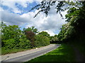
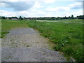
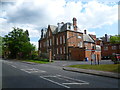
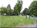
Photos of KT17 4JQ

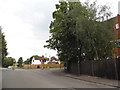
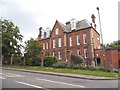
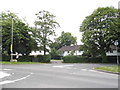
Area Information
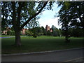
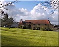
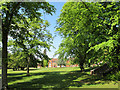
KT17 4JQ is a small, tightly knit residential postcode area in England, home to 1,561 people. It is a compact cluster of homes, predominantly occupied by owner-occupiers, with a median age of 47. The area’s character is defined by its quiet, family-oriented atmosphere, with a population skewed toward adults aged 30–64. Daily life here is shaped by proximity to local amenities and transport links, making it practical for commuters and families alike. The postcode lies within a region with strong digital connectivity, ensuring residents have reliable broadband and mobile coverage. While the area is small, it is well-connected to nearby towns and services, balancing seclusion with accessibility. Its low crime risk and absence of environmental constraints like protected woodlands or wetlands make it a stable, straightforward place to live. For those seeking a community with a clear identity, KT17 4JQ offers a straightforward, low-maintenance lifestyle without the complexities of larger urban areas.
- Area Type
- Postcode
- Area Size
- Not available
- Population
- 1561
- Population Density
- 1640 people/km²
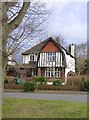
KT17 4JQ is a predominantly owner-occupied area, with 84% of properties owned by residents rather than rented. The accommodation type is houses, which suggests a focus on family homes and single-unit properties. This contrasts with areas dominated by flats or apartments, where rental markets are more common. The small size of the postcode means the housing stock is limited, but the high home ownership rate indicates a stable market with fewer turnover pressures. Buyers should expect a mix of traditional, possibly older properties, given the median age of residents. The area’s proximity to transport links and amenities may make it appealing to those seeking a balance between seclusion and convenience. However, the limited number of properties means competition could be fierce for available homes.
House Prices in KT17 4JQ
Showing 24 properties
| Address | Type | Beds | Baths | Last Sale Price | Last Sale Date | |
|---|---|---|---|---|---|---|
| 6B, Epsom College, College Road, Epsom, KT17 4JQ | Retail | 1 | 1 | - | - | |
| Crawfurd House, Epsom College, College Road, Epsom, KT17 4JQ | studentAccommodation | - | - | - | - | |
| Fayrer House Flat B, Epsom College, College Road, Epsom, KT17 4JQ | Flat | - | - | - | - | |
| Rosebery House Flat 1, Epsom College, College Road, Epsom, KT17 4JQ | Flat | - | - | - | - | |
| Rosebery House Flat 2, Epsom College, College Road, Epsom, KT17 4JQ | Flat | - | - | - | - | |
| White House, Epsom College, College Road, Epsom, KT17 4JQ | studentAccommodation | - | - | - | - | |
| Armoury Flat, Epsom College, College Road, Epsom, KT17 4JQ | Flat | - | - | - | - | |
| Newsom House Flat A, Epsom College, College Road, Epsom, KT17 4JQ | Flat | - | - | - | - | |
| 27 North Lodge, Epsom College, College Road, Epsom, KT17 4JQ | Flat | - | - | - | - | |
| 26 North Lodge, Epsom College, College Road, Epsom, KT17 4JQ | Flat | - | - | - | - |
Energy Efficiency in KT17 4JQ
Living in KT17 4JQ offers access to a range of practical amenities within easy reach. Retail options include major chains like Tesco, Lidl, and Co-op Epsom, providing everyday shopping convenience. The area’s rail and metro connections, including Epsom Railway Station and Mitcham Tram Stop, facilitate commuting to nearby towns. Ferry landings at Ditton Island and Kingston Town End Pier add to the transport diversity, though their utility may vary. The presence of multiple retail and transport hubs suggests a well-served community, balancing local needs with regional connectivity. While the area lacks detailed information on dining or leisure venues, the proximity to major services implies a functional, straightforward lifestyle focused on practicality and accessibility.
Amenities
Schools
The nearest school to KT17 4JQ is Epsom College, an independent institution. This type of school typically offers fee-paying education with a focus on academic and extracurricular excellence. While no Ofsted rating is provided, independent schools often attract families seeking structured, high-quality education. The absence of state schools in the data means the area’s educational options are limited to private institutions. For families prioritising independent schooling, Epsom College provides a clear choice, though it may not be accessible to all due to costs. The lack of state school options could be a consideration for buyers seeking affordability or diversity in education.
| Rank | School | Type | Entry gender | Ages |
|---|
Explore more schools in this area
Go to Schools tabDemographics
The community in KT17 4JQ is predominantly composed of adults aged 30–64, with a median age of 47. This suggests a mature, established population, likely with long-term ties to the area. Home ownership is high at 84%, indicating a strong presence of owner-occupied properties rather than rental units. The accommodation type is primarily houses, which aligns with the area’s residential character. The predominant ethnic group is White, reflecting a homogenous demographic profile. There is no data on deprivation levels, but the high home ownership and low crime risk imply a stable, middle-income community. The absence of specific diversity statistics means the area’s social fabric is largely defined by its core demographic. For buyers, this translates to a predictable, low-risk environment with a focus on long-term residency rather than transient populations.
Household Size
Accommodation Type
Tenure
Ethnic Group
Religion
Household Composition
Age
Household Deprivation
NS-SEC
Explore more demographic insights in this area
Go to Demographics tabPlanning
Planning Constraints
- Flood RiskPremium
- Ramsar Wetland SitesPremium
- Area of Outstanding Natural BeautyPremium
- Protected Nature ReservePremium
- Protected WoodlandPremium