Area Overview for KT17 4HH
Photos of KT17 4HH
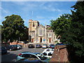
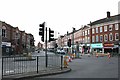
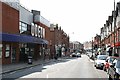
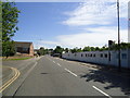
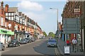
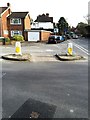
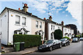
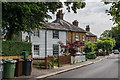
64 photos from this area
Area Information
Key information about the KT17 4HH including its size, population, and administrative classification.
- Area Type
- Postcode
- Area Size
- 8656 m²
- Population
- 1561
- Population Density
- 1640 people/km²
House Prices in KT17 4HH
10
Properties
£616,556
Average Sold Price
£245,000
Lowest Price
£950,000
Highest Price
Showing 10 properties
| Address | Type | Beds | Baths | Last Sale Price | Last Sale Date | |
|---|---|---|---|---|---|---|
| Orchard Cottage, 87A College Road, Epsom, KT17 4HH | Detached | 7 | 2 | £732,500 | Dec 2019 | |
| 77 College Road, Epsom, KT17 4HH | house | - | - | £925,000 | Oct 2016 | |
| 91 College Road, Epsom, KT17 4HH | Detached | 6 | - | £950,000 | Mar 2014 | |
| 75 College Road, Epsom, KT17 4HH | Detached | 3 | 2 | £350,000 | Jun 2013 | |
| 85 College Road, Epsom, KT17 4HH | Detached | - | - | £650,000 | Aug 2006 | |
| 83 College Road, Epsom, KT17 4HH | Detached | - | - | £580,000 | Nov 2004 | |
| Mulberry Cottage, 87 College Road, Epsom, KT17 4HH | Detached | 7 | - | £499,950 | Jul 2002 | |
| 89 College Road, Epsom, KT17 4HH | Detached | - | - | £245,000 | Oct 1996 | |
| 79 College Road, Epsom, KT17 4HH | Detached | 5 | 2 | - | - | |
| 81 College Road, Epsom, KT17 4HH | house | - | - | - | - |
Energy Efficiency in KT17 4HH
Amenities
Schools
| Rank | School | Type | Entry gender | Ages |
|---|
Explore more schools in this area
Go to Schools tabDemographics
Household Size
Family (3-5 people)
most common
Accommodation Type
Houses
most common
Tenure
84
majority
Ethnic Group
White
most common
Religion
N/A
most common
Household Composition
N/A
most common
Age
47
median
Adults (30-64 years)
most common
Household Deprivation
N/A
with no deprivation
NS-SEC
52
in Lower managerial occupations
Explore more demographic insights in this area
Go to Demographics tabPlanning
Planning Constraints
- Flood RiskPremium
- Ramsar Wetland SitesPremium
- Area of Outstanding Natural BeautyPremium
- Protected Nature ReservePremium
- Protected WoodlandPremium