Area Overview for KT17 4HF
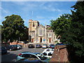
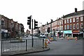
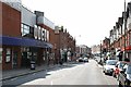
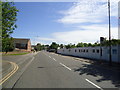
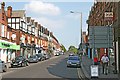
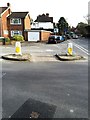
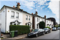
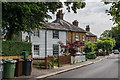
Photos of KT17 4HF
Area Information
KT17 4HF is a compact residential postcode in England, covering 907 square metres and home to 1,465 residents. Its high population density of 1.6 million people per square kilometre reflects a tightly knit community, where proximity to amenities and transport links is a defining feature. The area’s small size means it is likely a focused cluster of homes, possibly centred around local hubs or green spaces. Daily life here is shaped by its mix of residential and commuter-oriented infrastructure, with residents benefiting from nearby rail, metro, and ferry access. The area’s character is influenced by its demographics: a median age of 47, with a majority of residents aged 30–64. This suggests a mature, stable population, potentially with strong family ties and a focus on long-term living. KT17 4HF is not a sprawling suburb but a defined postcode, making it a microcosm of suburban life with a balance of convenience and community. For buyers, its small footprint means the surrounding areas are likely to be key for broader lifestyle and employment options.
- Area Type
- Postcode
- Area Size
- 907 m²
- Population
- 1465
- Population Density
- 3860 people/km²
KT17 4HF is predominantly an owner-occupied area, with 73% of residents living in their own homes. The accommodation type is primarily houses, indicating a mix of detached, semi-detached, or terraced properties typical of suburban settings. This suggests a market where long-term residency and family-oriented living are common, rather than a rental-heavy environment. The small postcode area means the housing stock is likely limited in scale, with properties concentrated around local amenities and transport routes. Buyers should consider the proximity to nearby rail and metro stations, such as Epsom and Mitcham, which may influence property value and desirability. The high home ownership rate also implies a stable market, with less turnover compared to areas with higher rental occupancy. However, the compact size of KT17 4HF means buyers may need to look beyond the immediate postcode for larger housing options or specific property types.
House Prices in KT17 4HF
Showing 1 properties
| Address | Type | Beds | Baths | Last Sale Price | Last Sale Date | |
|---|---|---|---|---|---|---|
| Linden House, 9 College Road, Epsom, KT17 4HF | hospital_care_home | - | - | - | - |
Energy Efficiency in KT17 4HF
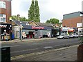
KT17 4HF offers a range of amenities within easy reach, including retail options like Lidl Upper and Co-op Epsom, which provide essential shopping and food services. The area’s proximity to rail stations, such as Epsom and Ewell East, and metro stops like Mitcham Tram Stop ensures convenient access to public transport, supporting both daily commutes and weekend excursions. Ferry landings, including Ditton Island Ferry Landing, offer scenic travel routes to Kingston, adding to the area’s leisure opportunities. While the data does not specify parks or recreational spaces, the presence of multiple transport hubs and retail venues suggests a lifestyle focused on connectivity and accessibility. The compact nature of the postcode means residents are likely to rely on nearby towns for larger amenities, but the immediate vicinity provides sufficient convenience for routine needs. This balance of proximity to services and transport links makes KT17 4HF suitable for those prioritising practicality over expansive local facilities.
Amenities
Schools
The nearest school to KT17 4HF is St Christopher’s School Trust (Epsom) Ltd, an independent institution. Independent schools typically offer fee-paying education, often with smaller class sizes and specialized curricula. While the data does not provide an Ofsted rating, the presence of an independent school suggests the area may attract families seeking alternative educational options. However, the absence of state schools in the data means it is unclear whether the area serves a broader demographic of students or is primarily focused on private education. For families prioritising state-run schools, the lack of listed state schools in the immediate vicinity may require additional research into nearby districts. The single school listed indicates a limited local educational infrastructure, which could be a consideration for those relying on proximity to schools for daily commuting or childcare needs.
| Rank | School | Type | Entry gender | Ages |
|---|
Explore more schools in this area
Go to Schools tabDemographics
The population of KT17 4HF is 1,465, with a median age of 47, indicating a community skewed towards middle-aged and older adults. The most common age range is 30–64 years, suggesting a mix of established professionals and families. Home ownership is high at 73%, with houses being the predominant accommodation type. This points to a stable, owner-occupied market, likely with semi-detached or terraced properties. The predominant ethnic group is White, though the data does not specify further diversity metrics. The area’s high population density of 1.6 million per square kilometre implies a tightly packed residential layout, which may influence local services and community dynamics. While the data does not provide deprivation statistics, the combination of high home ownership and a mature demographic suggests a relatively secure economic profile. However, the lack of detailed diversity data means the full picture of the community’s social makeup remains partially obscured.
Household Size
Accommodation Type
Tenure
Ethnic Group
Religion
Household Composition
Age
Household Deprivation
NS-SEC
Explore more demographic insights in this area
Go to Demographics tabPlanning
Planning Constraints
- Flood RiskPremium
- Ramsar Wetland SitesPremium
- Area of Outstanding Natural BeautyPremium
- Protected Nature ReservePremium
- Protected WoodlandPremium