Area Overview for KT17 4EH
Photos of KT17 4EH
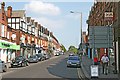
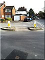
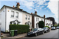
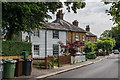
64 photos from this area
Area Information
Key information about the KT17 4EH including its size, population, and administrative classification.
- Area Type
- Postcode
- Area Size
- 7549 m²
- Population
- 1561
- Population Density
- 1640 people/km²
House Prices in KT17 4EH
43
Properties
£387,988
Average Sold Price
£151,000
Lowest Price
£630,000
Highest Price
Showing 43 properties
| Address | Type | Beds | Baths | Last Sale Price | Last Sale Date | |
|---|---|---|---|---|---|---|
| 18 Albert Road, Epsom, KT17 4EH | Terraced | 2 | 1 | £505,000 | Mar 2025 | |
| 4 Albert Road, Epsom, KT17 4EH | Terraced | 2 | 1 | £463,000 | Mar 2025 | |
| 56 Albert Road, Epsom, KT17 4EH | Semi-detached | 3 | 1 | £560,000 | Aug 2024 | |
| 46 Albert Road, Epsom, KT17 4EH | Terraced | 3 | 2 | £630,000 | Jul 2024 | |
| 12 Albert Road, Epsom, KT17 4EH | Terraced | 2 | 1 | £511,500 | Jul 2024 | |
| 28 Albert Road, Epsom, KT17 4EH | Terraced | 2 | 1 | £450,000 | Dec 2023 | |
| 10 Albert Road, Epsom, KT17 4EH | Terraced | 2 | 1 | £405,000 | Aug 2023 | |
| 36 Albert Road, Epsom, KT17 4EH | Terraced | 3 | 1 | £515,000 | Mar 2023 | |
| 60 Albert Road, Epsom, KT17 4EH | Semi-detached | 3 | - | £513,000 | Mar 2023 | |
| 62 Albert Road, Epsom, KT17 4EH | Detached | 2 | 1 | £530,000 | Jun 2021 |
Page 1 of 5
Energy Efficiency in KT17 4EH
Amenities
Schools
| Rank | School | Type | Entry gender | Ages |
|---|
Explore more schools in this area
Go to Schools tabDemographics
Household Size
Family (3-5 people)
most common
Accommodation Type
Houses
most common
Tenure
84
majority
Ethnic Group
White
most common
Religion
N/A
most common
Household Composition
N/A
most common
Age
47
median
Adults (30-64 years)
most common
Household Deprivation
N/A
with no deprivation
NS-SEC
52
in Lower managerial occupations
Explore more demographic insights in this area
Go to Demographics tabPlanning
Planning Constraints
- Flood RiskPremium
- Ramsar Wetland SitesPremium
- Area of Outstanding Natural BeautyPremium
- Protected Nature ReservePremium
- Protected WoodlandPremium