Area Overview for KT17 4AA
Photos of KT17 4AA
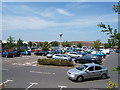

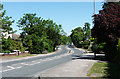

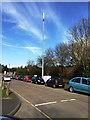
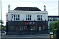
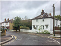
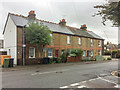

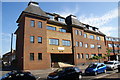
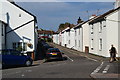

33 photos from this area
Area Information
Key information about the KT17 4AA including its size, population, and administrative classification.
- Area Type
- Postcode
- Area Size
- 9170 m²
- Population
- 2082
- Population Density
- 7300 people/km²
House Prices in KT17 4AA
53
Properties
£288,252
Average Sold Price
£74,000
Lowest Price
£465,000
Highest Price
Showing 53 properties
| Address | Type | Beds | Baths | Last Sale Price | Last Sale Date | |
|---|---|---|---|---|---|---|
| 33 Hawthorne Place, Epsom, KT17 4AA | Terraced | 2 | 1 | £435,000 | Aug 2025 | |
| 19 Hawthorne Place, Epsom, KT17 4AA | Terraced | 2 | 1 | £420,000 | Aug 2025 | |
| 29 Hawthorne Place, Epsom, KT17 4AA | Terraced | 2 | 1 | £435,000 | Jul 2025 | |
| 21 Hawthorne Place, Epsom, KT17 4AA | Terraced | 2 | 1 | £430,000 | Jul 2025 | |
| 15 Hawthorne Place, Epsom, KT17 4AA | house | 2 | 1 | £428,000 | Jun 2025 | |
| 12 Hawthorne Place, Epsom, KT17 4AA | Terraced | 2 | 1 | £365,000 | Mar 2025 | |
| 11 Hawthorne Place, Epsom, KT17 4AA | Terraced | 2 | 1 | £388,000 | Feb 2025 | |
| 20 Hawthorne Place, Epsom, KT17 4AA | Terraced | 2 | 1 | £410,000 | Sep 2024 | |
| 23 Hawthorne Place, Epsom, KT17 4AA | Terraced | 2 | 1 | £385,000 | Feb 2024 | |
| 39 Hawthorne Place, Epsom, KT17 4AA | Terraced | 2 | 1 | £396,500 | Sep 2023 |
Page 1 of 6
Energy Efficiency in KT17 4AA
Amenities
Schools
| Rank | School | Type | Entry gender | Ages |
|---|
Explore more schools in this area
Go to Schools tabDemographics
Household Size
One person
most common
Accommodation Type
Flats
most common
Tenure
56
majority
Ethnic Group
White
most common
Religion
N/A
most common
Household Composition
N/A
most common
Age
47
median
Adults (30-64 years)
most common
Household Deprivation
N/A
with no deprivation
NS-SEC
44
in Lower managerial occupations
Explore more demographic insights in this area
Go to Demographics tabPlanning
Planning Constraints
- Flood RiskPremium
- Ramsar Wetland SitesPremium
- Area of Outstanding Natural BeautyPremium
- Protected Nature ReservePremium
- Protected WoodlandPremium