Area Overview for KT17 3XT
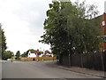
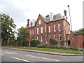
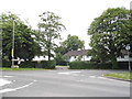
Photos of KT17 3XT

Area Information
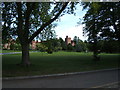
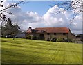
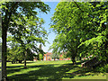
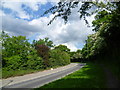
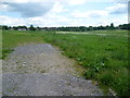
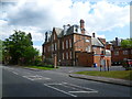
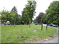
KT17 3XT is a small, tightly knit residential cluster in England with a population of 1561. Its compact size fosters a quiet, community-focused atmosphere, typical of areas where houses outnumber flats. The area’s proximity to Epsom and its surrounding infrastructure makes it a practical choice for those seeking a balance between suburban comfort and accessibility. Residents here are predominantly adults aged 30–64, with a median age of 47, suggesting a stable, mature demographic. The high home ownership rate of 84% indicates long-term residency and a sense of permanence. Daily life is shaped by the area’s low crime risk, excellent broadband connectivity, and proximity to rail networks. While it lacks major urban hubs, its small-scale charm and practical amenities cater to those prioritising safety, convenience, and a slower pace of life. The absence of environmental constraints such as protected woodlands or AONB designations means development is not restricted, though this also means the area lacks natural scenery. For buyers, KT17 3XT offers a straightforward, low-maintenance lifestyle with minimal external pressures.
- Area Type
- Postcode
- Area Size
- Not available
- Population
- 1561
- Population Density
- Not available
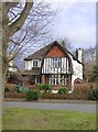
KT17 3XT is a predominantly owner-occupied area, with 84% of homes owned by residents rather than rented. This high home ownership rate suggests a community of long-term residents who have invested in their properties, contributing to a stable and low-turnover market. The accommodation type is exclusively houses, which is unusual for areas with higher apartment density. This means the housing stock is likely to consist of semi-detached or detached homes, offering more space and privacy than flats. For buyers, this creates a niche market where properties are not typically available for short-term rental or speculative investment. The small size of the area means the surrounding regions may offer more variety, but KT17 3XT itself is unlikely to have a significant rental sector. Buyers should consider the limited number of properties available and the potential for slower price appreciation compared to more dynamic urban areas.
House Prices in KT17 3XT
No properties found in this postcode.
Energy Efficiency in KT17 3XT
KT17 3XT offers a range of amenities within practical reach, including five retail outlets such as Lidl Upper, Co-op Epsom, and Tesco Fir. These shops provide everyday essentials, reducing the need for long trips. The area’s rail network connects residents to Epsom, Ewell East, and other stations, while metro stops like Mitcham Tram Stop and Belgrave Walk Tram Stop link to broader transport systems. Ferry landings such as Kingston Turks Pier and Ditton Island Ferry Landing add accessibility for those near waterways. The presence of multiple transport options and retail hubs suggests a well-served community, though the small area means residents may need to travel slightly for specialist services. The combination of shops, transport, and proximity to Epsom creates a lifestyle that balances convenience with the quietude of a smaller postcode.
Amenities
Schools
The nearest school to KT17 3XT is Epsom College, an independent institution. No other schools are listed in the data, so families relying on state education may need to look further afield. Epsom College’s independent status means it is likely to charge fees, catering to families seeking private schooling. The absence of state schools in the immediate vicinity suggests that residents must plan for commuting to nearby towns for public education options. For those prioritising private schooling, the proximity to Epsom College is a clear advantage, though it does not provide a comprehensive picture of the local education landscape. Parents should investigate additional schools in surrounding areas to ensure a full range of choices for their children.
| Rank | School | Type | Entry gender | Ages |
|---|
Explore more schools in this area
Go to Schools tabDemographics
The population of KT17 3XT is 1561, with a median age of 47. This places the area firmly in the adult demographic, with 84% of residents owning their homes. The majority of households are likely to be family units or couples, given the age range of 30–64 years, which aligns with traditional home-owning demographics. The accommodation type is predominantly houses, which suggests a focus on single-family living rather than apartments or shared housing. The predominant ethnic group is White, though no data on diversity or deprivation is provided. The high home ownership rate implies a stable, long-term community with limited rental activity. This demographic profile indicates a mature, established area where residents are likely to be professionals, retirees, or families seeking a settled environment. The absence of specific data on deprivation means the quality of life can be inferred from the low crime risk and strong digital connectivity, which support a comfortable lifestyle.
Household Size
Accommodation Type
Tenure
Ethnic Group
Religion
Household Composition
Age
Household Deprivation
NS-SEC
Explore more demographic insights in this area
Go to Demographics tabPlanning
Planning Constraints
- Flood RiskPremium
- Ramsar Wetland SitesPremium
- Area of Outstanding Natural BeautyPremium
- Protected Nature ReservePremium
- Protected WoodlandPremium
- Crime RiskPremium