Area Overview for KT17 3NX
Photos of KT17 3NX
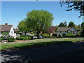
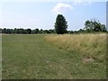
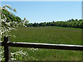
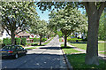
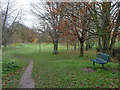
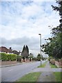
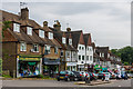
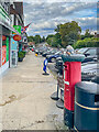


27 photos from this area
Area Information
Key information about the KT17 3NX including its size, population, and administrative classification.
- Area Type
- Postcode
- Area Size
- 1.1 hectares
- Population
- 1654
- Population Density
- 2379 people/km²
House Prices in KT17 3NX
23
Properties
£402,250
Average Sold Price
£208,000
Lowest Price
£590,000
Highest Price
Showing 23 properties
| Address | Type | Beds | Baths | Last Sale Price | Last Sale Date | |
|---|---|---|---|---|---|---|
| 20 Rose Bushes, Epsom Downs, KT17 3NX | Terraced | 4 | 2 | £590,000 | Mar 2025 | |
| 40 Rose Bushes, Epsom Downs, KT17 3NX | Terraced | 4 | 1 | £560,000 | Jul 2024 | |
| 42 Rose Bushes, Epsom Downs, KT17 3NX | Terraced | 4 | 2 | £580,000 | Sep 2022 | |
| 16 Rose Bushes, Epsom Downs, KT17 3NX | Terraced | 4 | 2 | £480,000 | Mar 2017 | |
| 38 Rose Bushes, Epsom Downs, KT17 3NX | house | 4 | - | £430,000 | Feb 2015 | |
| 22 Rose Bushes, Epsom Downs, KT17 3NX | Terraced | 4 | 2 | £415,000 | Nov 2014 | |
| 10 Rose Bushes, Epsom Downs, KT17 3NX | Terraced | 4 | - | £383,000 | Jul 2014 | |
| 12 Rose Bushes, Epsom Downs, KT17 3NX | house | - | - | £330,000 | May 2010 | |
| 28 Rose Bushes, Epsom Downs, KT17 3NX | house | - | - | £315,000 | Nov 2009 | |
| 26 Rose Bushes, Epsom Downs, KT17 3NX | Terraced | 4 | 2 | £296,000 | Nov 2008 |
Page 1 of 3
Energy Efficiency in KT17 3NX
Amenities
Schools
| Rank | School | Type | Entry gender | Ages |
|---|
Explore more schools in this area
Go to Schools tabDemographics
Household Size
Family (3-5 people)
most common
Accommodation Type
Houses
most common
Tenure
92
majority
Ethnic Group
White
most common
Religion
N/A
most common
Household Composition
N/A
most common
Age
47
median
Adults (30-64 years)
most common
Household Deprivation
N/A
with no deprivation
NS-SEC
50
in Lower managerial occupations
Explore more demographic insights in this area
Go to Demographics tabPlanning
Planning Constraints
- Flood RiskPremium
- Ramsar Wetland SitesPremium
- Area of Outstanding Natural BeautyPremium
- Protected Nature ReservePremium
- Protected WoodlandPremium