Area Overview for KT17 3LW
Photos of KT17 3LW
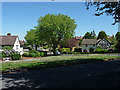
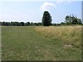
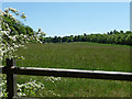
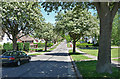
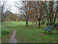
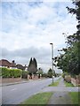
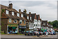
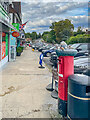
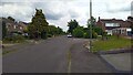
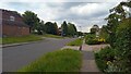


27 photos from this area
Area Information
Key information about the KT17 3LW including its size, population, and administrative classification.
- Area Type
- Postcode
- Area Size
- 3.9 hectares
- Population
- Not available
- Population Density
- Not available
House Prices in KT17 3LW
41
Properties
£461,335
Average Sold Price
£155,000
Lowest Price
£930,000
Highest Price
Showing 41 properties
| Address | Type | Beds | Baths | Last Sale Price | Last Sale Date | |
|---|---|---|---|---|---|---|
| 123 Ruden Way, Epsom Downs, KT17 3LW | Semi-detached | 3 | 1 | £600,000 | Jul 2025 | |
| 121 Ruden Way, Epsom Downs, KT17 3LW | Semi-detached | 3 | 1 | £540,000 | Jun 2025 | |
| 133 Ruden Way, Epsom Downs, KT17 3LW | Semi-detached | 3 | 2 | £750,000 | Feb 2023 | |
| 139 Ruden Way, Epsom Downs, KT17 3LW | house | - | - | £620,000 | Sep 2022 | |
| 97 Ruden Way, Epsom Downs, KT17 3LW | house | - | - | £930,000 | Aug 2022 | |
| 141 Ruden Way, Epsom Downs, KT17 3LW | house | - | - | £525,000 | Apr 2022 | |
| 147 Ruden Way, Epsom Downs, KT17 3LW | Semi-detached | 3 | 2 | £568,000 | Jan 2021 | |
| 149 Ruden Way, Epsom Downs, KT17 3LW | Semi-detached | 3 | 1 | £510,000 | Feb 2020 | |
| 113 Ruden Way, Epsom Downs, KT17 3LW | house | - | - | £510,000 | Jan 2020 | |
| 85 Ruden Way, Epsom Downs, KT17 3LW | Semi-detached | 3 | 1 | £637,000 | Apr 2019 |
Page 1 of 5
Energy Efficiency in KT17 3LW
Amenities
Schools
| Rank | School | Type | Entry gender | Ages |
|---|
Explore more schools in this area
Go to Schools tabDemographics
Household Size
Family (3-5 people)
most common
Accommodation Type
Houses
most common
Tenure
85
majority
Ethnic Group
White
most common
Religion
N/A
most common
Household Composition
N/A
most common
Age
47
median
Adults (30-64 years)
most common
Household Deprivation
N/A
with no deprivation
NS-SEC
44
in Lower managerial occupations
Explore more demographic insights in this area
Go to Demographics tabPlanning
Planning Constraints
- Flood RiskPremium
- Ramsar Wetland SitesPremium
- Area of Outstanding Natural BeautyPremium
- Protected Nature ReservePremium
- Protected WoodlandPremium