Area Overview for KT17 3EG
Photos of KT17 3EG
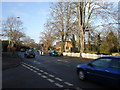
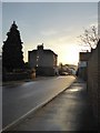
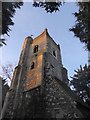
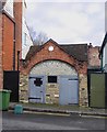
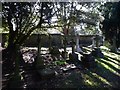

74 photos from this area
Area Information
Key information about the KT17 3EG including its size, population, and administrative classification.
- Area Type
- Postcode
- Area Size
- 1.8 hectares
- Population
- Not available
- Population Density
- Not available
House Prices in KT17 3EG
17
Properties
£689,357
Average Sold Price
£194,000
Lowest Price
£1,540,000
Highest Price
Showing 17 properties
| Address | Type | Beds | Baths | Last Sale Price | Last Sale Date | |
|---|---|---|---|---|---|---|
| 63 Cheam Road, Ewell, KT17 3EG | Detached | 5 | 2 | £857,500 | Mar 2025 | |
| 85 Cheam Road, Ewell, KT17 3EG | Detached | 6 | 4 | £1,540,000 | Aug 2024 | |
| 79 Cheam Road, Ewell, KT17 3EG | Detached | 4 | 3 | £996,000 | Jun 2020 | |
| 83 Cheam Road, Ewell, KT17 3EG | Detached | 5 | 2 | £995,000 | May 2018 | |
| 67 Cheam Road, Ewell, KT17 3EG | Detached | 4 | 2 | £840,000 | Oct 2016 | |
| 61 Cheam Road, Ewell, KT17 3EG | Detached | 4 | 1 | £741,000 | Mar 2016 | |
| 71 Cheam Road, Ewell, KT17 3EG | house | - | - | £679,000 | Nov 2013 | |
| 91 Cheam Road, Ewell, KT17 3EG | Detached | - | - | £595,000 | Oct 2009 | |
| 65 Cheam Road, Ewell, KT17 3EG | Detached | - | - | £610,000 | Aug 2009 | |
| 89 Cheam Road, Ewell, KT17 3EG | Detached | - | - | £592,500 | Oct 2008 |
Page 1 of 2
Energy Efficiency in KT17 3EG
Amenities
Schools
| Rank | School | Type | Entry gender | Ages |
|---|
Explore more schools in this area
Go to Schools tabDemographics
Household Size
Family (3-5 people)
most common
Accommodation Type
Houses
most common
Tenure
96
majority
Ethnic Group
White
most common
Religion
N/A
most common
Household Composition
N/A
most common
Age
47
median
Adults (30-64 years)
most common
Household Deprivation
N/A
with no deprivation
NS-SEC
51
in Lower managerial occupations
Explore more demographic insights in this area
Go to Demographics tabPlanning
Planning Constraints
- Flood RiskPremium
- Ramsar Wetland SitesPremium
- Area of Outstanding Natural BeautyPremium
- Protected Nature ReservePremium
- Protected WoodlandPremium