Area Overview for KT17 2QH
Photos of KT17 2QH
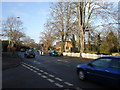
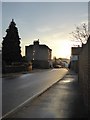
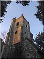
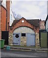
74 photos from this area
Area Information
Key information about the KT17 2QH including its size, population, and administrative classification.
- Area Type
- Postcode
- Area Size
- 9872 m²
- Population
- 1706
- Population Density
- 792 people/km²
House Prices in KT17 2QH
16
Properties
£623,537
Average Sold Price
£285,000
Lowest Price
£995,000
Highest Price
Showing 16 properties
| Address | Type | Beds | Baths | Last Sale Price | Last Sale Date | |
|---|---|---|---|---|---|---|
| 7 Boleyn Avenue, Ewell, KT17 2QH | house | - | - | £630,000 | Jan 2023 | |
| 15 Boleyn Avenue, Ewell, KT17 2QH | Detached | 5 | 3 | £891,000 | Jun 2022 | |
| 14 Boleyn Avenue, Ewell, KT17 2QH | house | - | - | £995,000 | Jun 2021 | |
| 9 Boleyn Avenue, Ewell, KT17 2QH | house | - | - | £870,000 | Jan 2021 | |
| 13 Boleyn Avenue, Ewell, KT17 2QH | Detached | 3 | 1 | £730,000 | Oct 2020 | |
| 6 Boleyn Avenue, Ewell, KT17 2QH | Detached | 4 | 3 | £900,000 | Feb 2016 | |
| 8 Boleyn Avenue, Ewell, KT17 2QH | Detached | 3 | - | £575,000 | Jan 2014 | |
| 10 Boleyn Avenue, Ewell, KT17 2QH | house | 4 | - | £520,000 | May 2011 | |
| 4 Boleyn Avenue, Ewell, KT17 2QH | Detached | - | - | £464,980 | Jun 2006 | |
| 12 Boleyn Avenue, Ewell, KT17 2QH | Detached | - | - | £355,000 | Oct 2003 |
Page 1 of 2
Energy Efficiency in KT17 2QH
Amenities
Schools
| Rank | School | Type | Entry gender | Ages |
|---|
Explore more schools in this area
Go to Schools tabDemographics
Household Size
Family (3-5 people)
most common
Accommodation Type
Houses
most common
Tenure
96
majority
Ethnic Group
White
most common
Religion
N/A
most common
Household Composition
N/A
most common
Age
47
median
Adults (30-64 years)
most common
Household Deprivation
N/A
with no deprivation
NS-SEC
56
in Lower managerial occupations
Explore more demographic insights in this area
Go to Demographics tabPlanning
Planning Constraints
- Flood RiskPremium
- Ramsar Wetland SitesPremium
- Area of Outstanding Natural BeautyPremium
- Protected Nature ReservePremium
- Protected WoodlandPremium