Area Overview for KT17 2JN
Photos of KT17 2JN
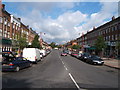

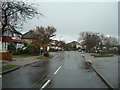
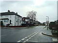
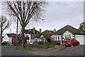

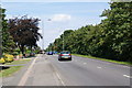
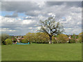
31 photos from this area
Area Information
Key information about the KT17 2JN including its size, population, and administrative classification.
- Area Type
- Postcode
- Area Size
- 5351 m²
- Population
- 1793
- Population Density
- 4992 people/km²
House Prices in KT17 2JN
12
Properties
£434,550
Average Sold Price
£164,950
Lowest Price
£775,000
Highest Price
Showing 12 properties
| Address | Type | Beds | Baths | Last Sale Price | Last Sale Date | |
|---|---|---|---|---|---|---|
| 112 Woodstone Avenue, Stoneleigh, KT17 2JN | house | 3 | 1 | £690,000 | Jun 2022 | |
| 118 Woodstone Avenue, Stoneleigh, KT17 2JN | Semi-detached | 3 | - | £552,000 | Dec 2018 | |
| 126 Woodstone Avenue, Stoneleigh, KT17 2JN | Semi-detached | 5 | 2 | £775,000 | Aug 2018 | |
| 122 Woodstone Avenue, Stoneleigh, KT17 2JN | Semi-detached | 3 | 2 | £587,000 | May 2016 | |
| 120 Woodstone Avenue, Stoneleigh, KT17 2JN | Semi-detached | 3 | 1 | £357,000 | Feb 2012 | |
| 114 Woodstone Avenue, Stoneleigh, KT17 2JN | house | - | - | £250,000 | May 2006 | |
| 110 Woodstone Avenue, Stoneleigh, KT17 2JN | Semi-detached | - | - | £275,000 | Feb 2005 | |
| 104 Woodstone Avenue, Stoneleigh, KT17 2JN | Semi-detached | - | - | £260,000 | Jul 2001 | |
| 124 Woodstone Avenue, Stoneleigh, KT17 2JN | Retail | 3 | 1 | £164,950 | Oct 1999 | |
| 106 Woodstone Avenue, Stoneleigh, KT17 2JN | Semi-detached | - | - | - | - |
Page 1 of 2
Energy Efficiency in KT17 2JN
Amenities
Schools
| Rank | School | Type | Entry gender | Ages |
|---|
Explore more schools in this area
Go to Schools tabDemographics
Household Size
Family (3-5 people)
most common
Accommodation Type
Houses
most common
Tenure
97
majority
Ethnic Group
White
most common
Religion
N/A
most common
Household Composition
N/A
most common
Age
47
median
Adults (30-64 years)
most common
Household Deprivation
N/A
with no deprivation
NS-SEC
47
in Lower managerial occupations
Explore more demographic insights in this area
Go to Demographics tabPlanning
Planning Constraints
- Flood RiskPremium
- Ramsar Wetland SitesPremium
- Area of Outstanding Natural BeautyPremium
- Protected Nature ReservePremium
- Protected WoodlandPremium