Area Overview for KT17 2DS
Photos of KT17 2DS

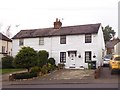

71 photos from this area
Area Information
Key information about the KT17 2DS including its size, population, and administrative classification.
- Area Type
- Postcode
- Area Size
- 5439 m²
- Population
- 2032
- Population Density
- 3628 people/km²
House Prices in KT17 2DS
9
Properties
£438,214
Average Sold Price
£320,000
Lowest Price
£690,000
Highest Price
Showing 9 properties
| Address | Type | Beds | Baths | Last Sale Price | Last Sale Date | |
|---|---|---|---|---|---|---|
| 3, Ernest Cottages, Kingston Road, Epsom, KT17 2DS | Terraced | 3 | 1 | £400,000 | Jul 2025 | |
| 6, Ernest Cottages, Kingston Road, Epsom, KT17 2DS | Terraced | 3 | 1 | £425,000 | Aug 2023 | |
| 9, Ernest Cottages, Kingston Road, Epsom, KT17 2DS | Detached | 3 | 1 | £690,000 | Feb 2023 | |
| 4, Ernest Cottages, Kingston Road, Epsom, KT17 2DS | Cottage | 2 | 1 | £432,500 | Sep 2021 | |
| 7, Ernest Cottages, Kingston Road, Epsom, KT17 2DS | Cottage | 2 | 1 | £350,000 | Feb 2018 | |
| 5, Ernest Cottages, Kingston Road, Epsom, KT17 2DS | Terraced | 3 | 1 | £450,000 | Aug 2017 | |
| 8, Ernest Cottages, Kingston Road, Epsom, KT17 2DS | house | - | - | £320,000 | Nov 2014 | |
| 1, Ernest Cottages, Kingston Road, Epsom, KT17 2DS | Cottage | 3 | 1 | - | - | |
| 2, Ernest Cottages, Kingston Road, Epsom, KT17 2DS | house | - | - | - | - |
Energy Efficiency in KT17 2DS
Amenities
Schools
| Rank | School | Type | Entry gender | Ages |
|---|
Explore more schools in this area
Go to Schools tabDemographics
Household Size
Family (3-5 people)
most common
Accommodation Type
Houses
most common
Tenure
62
majority
Ethnic Group
White
most common
Religion
N/A
most common
Household Composition
N/A
most common
Age
47
median
Adults (30-64 years)
most common
Household Deprivation
N/A
with no deprivation
NS-SEC
44
in Lower managerial occupations
Explore more demographic insights in this area
Go to Demographics tabPlanning
Planning Constraints
- Flood RiskPremium
- Ramsar Wetland SitesPremium
- Area of Outstanding Natural BeautyPremium
- Protected Nature ReservePremium
- Protected WoodlandPremium