Area Overview for KT17 2DE
Photos of KT17 2DE
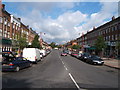

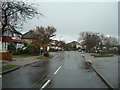
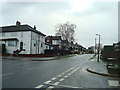
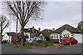
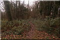
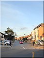
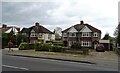
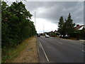

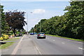
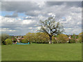
31 photos from this area
Area Information
Key information about the KT17 2DE including its size, population, and administrative classification.
- Area Type
- Postcode
- Area Size
- 3.1 hectares
- Population
- 1706
- Population Density
- 792 people/km²
House Prices in KT17 2DE
24
Properties
£464,884
Average Sold Price
£245,000
Lowest Price
£800,000
Highest Price
Showing 24 properties
| Address | Type | Beds | Baths | Last Sale Price | Last Sale Date | |
|---|---|---|---|---|---|---|
| 357 London Road, Ewell, KT17 2DE | Semi-detached | 11 | 1 | £800,000 | Aug 2024 | |
| 361 London Road, Ewell, KT17 2DE | house | 3 | - | £710,000 | Nov 2022 | |
| 363 London Road, Ewell, KT17 2DE | house | - | - | £665,000 | Jun 2021 | |
| 341 London Road, Ewell, KT17 2DE | house | - | - | £630,000 | Apr 2021 | |
| 375 London Road, Ewell, KT17 2DE | house | - | - | £620,000 | Mar 2021 | |
| 365 London Road, Ewell, KT17 2DE | house | 3 | - | £395,000 | Sep 2010 | |
| 371 London Road, Ewell, KT17 2DE | Detached | - | - | £370,000 | Aug 2008 | |
| 343 London Road, Ewell, KT17 2DE | Semi-detached | - | - | £435,000 | Oct 2007 | |
| 377 London Road, Ewell, KT17 2DE | Semi-detached | - | - | £338,500 | Feb 2006 | |
| 345 London Road, Ewell, KT17 2DE | Semi-detached | - | - | £336,000 | Jul 2004 |
Page 1 of 3
Energy Efficiency in KT17 2DE
Amenities
Schools
| Rank | School | Type | Entry gender | Ages |
|---|
Explore more schools in this area
Go to Schools tabDemographics
Household Size
Family (3-5 people)
most common
Accommodation Type
Houses
most common
Tenure
96
majority
Ethnic Group
White
most common
Religion
N/A
most common
Household Composition
N/A
most common
Age
47
median
Adults (30-64 years)
most common
Household Deprivation
N/A
with no deprivation
NS-SEC
56
in Lower managerial occupations
Explore more demographic insights in this area
Go to Demographics tabPlanning
Planning Constraints
- Flood RiskPremium
- Ramsar Wetland SitesPremium
- Area of Outstanding Natural BeautyPremium
- Protected Nature ReservePremium
- Protected WoodlandPremium