Area Overview for KT17 2BU
Photos of KT17 2BU
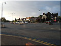
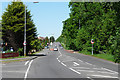
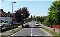

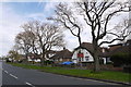
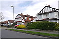
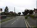


45 photos from this area
Area Information
Key information about the KT17 2BU including its size, population, and administrative classification.
- Area Type
- Postcode
- Area Size
- 8.6 hectares
- Population
- 1706
- Population Density
- 792 people/km²
House Prices in KT17 2BU
32
Properties
£400,997
Average Sold Price
£86,500
Lowest Price
£1,095,000
Highest Price
Showing 32 properties
| Address | Type | Beds | Baths | Last Sale Price | Last Sale Date | |
|---|---|---|---|---|---|---|
| 231 London Road, Ewell, KT17 2BU | Maisonette | 2 | 1 | £415,000 | Jul 2024 | |
| 213 London Road, Ewell, KT17 2BU | Semi-detached | 4 | 2 | £695,000 | Apr 2024 | |
| 231A London Road, Ewell, KT17 2BU | Maisonette | 2 | 1 | £385,000 | Jan 2023 | |
| 255 London Road, Ewell, KT17 2BU | Retail | 5 | 2 | £915,000 | Jul 2022 | |
| 245 London Road, Ewell, KT17 2BU | Bungalow | 2 | - | £1,095,000 | Jun 2022 | |
| 211 London Road, Ewell, KT17 2BU | house | - | - | £735,000 | May 2021 | |
| 233 London Road, Ewell, KT17 2BU | Flat | - | - | £385,000 | Feb 2021 | |
| 225 London Road, Ewell, KT17 2BU | Maisonette | 2 | 1 | £327,500 | Nov 2019 | |
| 241 London Road, Ewell, KT17 2BU | Flat | - | - | £325,000 | Oct 2015 | |
| 249 London Road, Ewell, KT17 2BU | Semi-detached | 4 | - | £515,000 | Apr 2015 |
Page 1 of 4
Energy Efficiency in KT17 2BU
Amenities
Schools
| Rank | School | Type | Entry gender | Ages |
|---|
Explore more schools in this area
Go to Schools tabDemographics
Household Size
Family (3-5 people)
most common
Accommodation Type
Houses
most common
Tenure
96
majority
Ethnic Group
White
most common
Religion
N/A
most common
Household Composition
N/A
most common
Age
47
median
Adults (30-64 years)
most common
Household Deprivation
N/A
with no deprivation
NS-SEC
56
in Lower managerial occupations
Explore more demographic insights in this area
Go to Demographics tabPlanning
Planning Constraints
- Flood RiskPremium
- Ramsar Wetland SitesPremium
- Area of Outstanding Natural BeautyPremium
- Protected Nature ReservePremium
- Protected WoodlandPremium