Area Overview for KT17 1XB
Photos of KT17 1XB
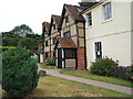
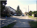
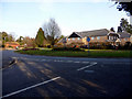
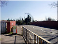
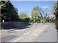
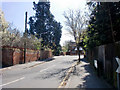

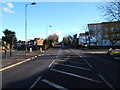
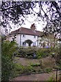
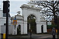
100 photos from this area
Area Information
Key information about the KT17 1XB including its size, population, and administrative classification.
- Area Type
- Postcode
- Area Size
- 8213 m²
- Population
- 2032
- Population Density
- 3628 people/km²
House Prices in KT17 1XB
14
Properties
£506,265
Average Sold Price
£20,000
Lowest Price
£1,075,000
Highest Price
Showing 14 properties
| Address | Type | Beds | Baths | Last Sale Price | Last Sale Date | |
|---|---|---|---|---|---|---|
| 70 West Street, Ewell, KT17 1XB | Terraced | 2 | 1 | £450,000 | Nov 2025 | |
| 66 West Street, Ewell, KT17 1XB | Terraced | 2 | 1 | £450,000 | May 2023 | |
| 64 West Street, Ewell, KT17 1XB | house | - | - | £425,000 | Nov 2021 | |
| 52 West Street, Ewell, KT17 1XB | Detached | 4 | 2 | £796,000 | Aug 2020 | |
| 74 West Street, Ewell, KT17 1XB | Detached | - | - | £20,000 | Feb 2018 | |
| 50 West Street, Ewell, KT17 1XB | Detached | 2 | 1 | £735,000 | Aug 2017 | |
| 48 West Street, Ewell, KT17 1XB | Detached | 4 | 2 | £1,075,000 | Jan 2017 | |
| 58 West Street, Ewell, KT17 1XB | Detached | 3 | - | £630,000 | Dec 2014 | |
| 60 West Street, Ewell, KT17 1XB | Detached | 3 | - | £529,000 | Feb 2014 | |
| 68 West Street, Ewell, KT17 1XB | house | 2 | - | £239,000 | Mar 2012 |
Page 1 of 2
Energy Efficiency in KT17 1XB
Amenities
Schools
| Rank | School | Type | Entry gender | Ages |
|---|
Explore more schools in this area
Go to Schools tabDemographics
Household Size
Family (3-5 people)
most common
Accommodation Type
Houses
most common
Tenure
62
majority
Ethnic Group
White
most common
Religion
N/A
most common
Household Composition
N/A
most common
Age
47
median
Adults (30-64 years)
most common
Household Deprivation
N/A
with no deprivation
NS-SEC
44
in Lower managerial occupations
Explore more demographic insights in this area
Go to Demographics tabPlanning
Planning Constraints
- Flood RiskPremium
- Ramsar Wetland SitesPremium
- Area of Outstanding Natural BeautyPremium
- Protected Nature ReservePremium
- Protected WoodlandPremium