Area Overview for KT17 1JB
Photos of KT17 1JB

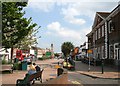
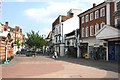
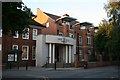
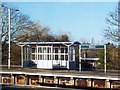
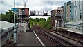
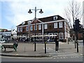
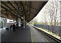
85 photos from this area
Area Information
Key information about the KT17 1JB including its size, population, and administrative classification.
- Area Type
- Postcode
- Area Size
- 1.7 hectares
- Population
- 1398
- Population Density
- 6044 people/km²
House Prices in KT17 1JB
53
Properties
£331,873
Average Sold Price
£102,000
Lowest Price
£555,000
Highest Price
Showing 53 properties
| Address | Type | Beds | Baths | Last Sale Price | Last Sale Date | |
|---|---|---|---|---|---|---|
| 33 Adelphi Road, Epsom, KT17 1JB | Semi-detached | 2 | 1 | £450,000 | Mar 2025 | |
| 21 Adelphi Road, Epsom, KT17 1JB | Terraced | 2 | 1 | £340,000 | Dec 2024 | |
| 10 Adelphi Road, Epsom, KT17 1JB | Terraced | 2 | 1 | £425,000 | May 2024 | |
| 15 Adelphi Road, Epsom, KT17 1JB | Terraced | 2 | 1 | £319,000 | Mar 2024 | |
| 19 Adelphi Road, Epsom, KT17 1JB | Terraced | 2 | 1 | £380,000 | May 2023 | |
| 23 Adelphi Road, Epsom, KT17 1JB | Terraced | 2 | 1 | £357,000 | Apr 2023 | |
| 42 Adelphi Road, Epsom, KT17 1JB | Terraced | 2 | 1 | £555,000 | Mar 2023 | |
| 17 Adelphi Road, Epsom, KT17 1JB | Terraced | 2 | 1 | £395,000 | Oct 2022 | |
| 44 Adelphi Road, Epsom, KT17 1JB | Terraced | 2 | 1 | £445,500 | Aug 2022 | |
| 28 Adelphi Road, Epsom, KT17 1JB | Terraced | 2 | 1 | £500,000 | Jul 2022 |
Page 1 of 6
Energy Efficiency in KT17 1JB
Amenities
Schools
| Rank | School | Type | Entry gender | Ages |
|---|
Explore more schools in this area
Go to Schools tabDemographics
Household Size
One person
most common
Accommodation Type
Flats
most common
Tenure
43
majority
Ethnic Group
White
most common
Religion
N/A
most common
Household Composition
N/A
most common
Age
47
median
Adults (30-64 years)
most common
Household Deprivation
N/A
with no deprivation
NS-SEC
37
in Lower managerial occupations
Explore more demographic insights in this area
Go to Demographics tabPlanning
Planning Constraints
- Flood RiskPremium
- Ramsar Wetland SitesPremium
- Area of Outstanding Natural BeautyPremium
- Protected Nature ReservePremium
- Protected WoodlandPremium