Area Overview for KT17 1DZ
Photos of KT17 1DZ


Area Information
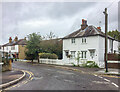
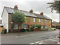
KT17 1DZ is a small, tightly knit residential postcode in England, home to just 1,759 residents. The area is characterised by a mature demographic, with a median age of 47 and a majority of adults aged 30–64. This suggests a community rooted in stability, with many long-term residents and families. The postcode covers a compact cluster of homes, predominantly houses, reflecting a traditional suburban layout. Living here offers proximity to essential services, including retail outlets like Sainsburys Kiln and Co-op Epsom, as well as multiple rail stations and ferry landings. The area’s small size means amenities are within practical reach, though it is not a densely populated urban hub. Its appeal lies in a balance of residential tranquillity and access to transport networks, making it suitable for those seeking a settled lifestyle without sacrificing connectivity. The postcode’s compact nature also means it is well served by nearby towns like Epsom, which provide additional facilities. For buyers, KT17 1DZ represents a niche market with limited housing stock, offering a quiet, community-focused environment.
- Area Type
- Postcode
- Area Size
- Not available
- Population
- 1759
- Population Density
- 4855 people/km²
KT17 1DZ is primarily an owner-occupied area, with 59% of residents living in homes they own. The accommodation type is predominantly houses, which is typical of suburban or semi-rural postcodes. This suggests a market skewed towards family homes rather than apartments or rental properties. Given the small population and limited housing stock, the area is unlikely to have a large rental market, and property availability is likely constrained. Buyers should consider that the area’s compact size means competition for homes may be fierce, particularly for those seeking larger properties. The focus on houses also implies that the local housing stock is less likely to include modern developments or high-density housing. For those prioritising proximity to transport, the nearby rail and metro stations could enhance the area’s appeal, though the small size of KT17 1DZ means buyers must look beyond the postcode for broader property options.
House Prices in KT17 1DZ
No properties found in this postcode.
Energy Efficiency in KT17 1DZ
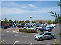
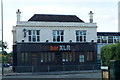
Living in KT17 1DZ provides access to a range of amenities within practical reach. Retail options include Sainsburys Kiln, Lidl Upper, and Co-op Epsom, ensuring everyday shopping needs are met. The area’s proximity to rail stations like Epsom and Ewell West, along with metro stops such as Belgrave Walk Tram Stop, offers seamless connections to larger towns and cities. Ferry landings, including Kingston Turks Pier, add to the transport diversity. While the postcode itself has limited leisure facilities, nearby areas likely host parks, cafes, and other amenities. The presence of multiple retail and transport hubs suggests a lifestyle that balances convenience with a small-community feel. Residents can enjoy local shopping and easy access to broader networks, though the area’s compact nature means some amenities require a short trip outside KT17 1DZ.
Amenities
Schools
The nearest school to KT17 1DZ is Lintons Lane Centre, categorised as an "other" type of educational facility. No specific Ofsted rating is provided in the data, so its quality cannot be assessed here. The limited number of schools nearby suggests that families may need to look beyond the immediate postcode for comprehensive educational options. The absence of primary or secondary schools within KT17 1DZ itself means that prospective buyers with children should investigate nearby towns like Epsom, which are likely to have more extensive school networks. The single listed school may serve specific needs, such as community centres or alternative education providers, but it is not a substitute for traditional schools. For families prioritising strong local schools, the area’s small size may necessitate a broader search for educational facilities.
| Rank | School | Type | Entry gender | Ages |
|---|
Explore more schools in this area
Go to Schools tabDemographics
The population of KT17 1DZ is 1,759, with a median age of 47, indicating a predominantly middle-aged community. The most common age range is 30–64, suggesting a mix of established professionals, families, and retirees. Home ownership is strong, with 59% of residents owning their homes, a figure that aligns with a residential area focused on long-term occupancy. The primary accommodation type is houses, reflecting a suburban or semi-rural character. The predominant ethnic group is White, though the data does not specify further diversity metrics. This demographic profile implies a stable, low-turnover community where property values may be influenced by local amenities and transport links. The absence of detailed deprivation data means no specific claims can be made about economic hardship, but the high home ownership rate and age distribution suggest a relatively affluent or middle-income area.
Household Size
Accommodation Type
Tenure
Ethnic Group
Religion
Household Composition
Age
Household Deprivation
NS-SEC
Explore more demographic insights in this area
Go to Demographics tabPlanning
Planning Constraints
- Flood RiskPremium
- Ramsar Wetland SitesPremium
- Area of Outstanding Natural BeautyPremium
- Protected Nature ReservePremium
- Protected WoodlandPremium